Catalog Archive
Auction 130, Lot 353

"A New Chart of the Bahama Islands and the Windward Passage", Mount & Page
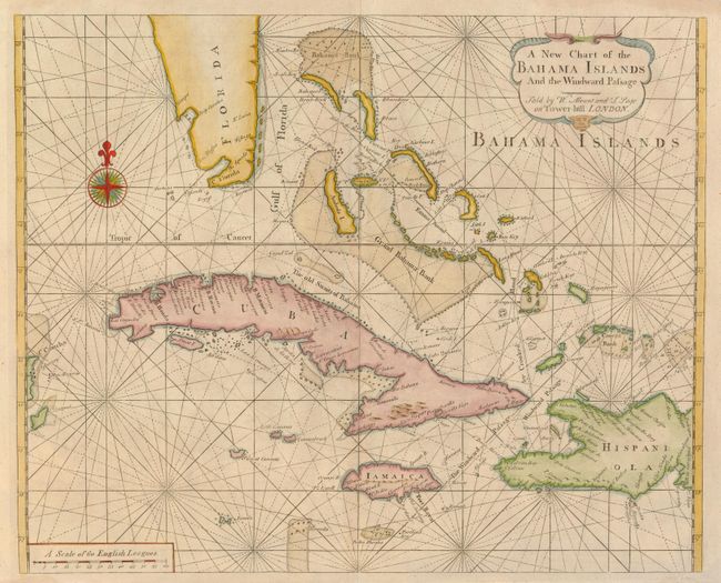
Subject: Bahamas

Period: 1737 (circa)

Publication: The English Pilot - The Fourth Book Describing West India Navigation.

Color: Hand Color

Size:
20.5 x 16.7 inches
52.1 x 42.4 cm
Download High Resolution Image
(or just click on image to launch the Zoom viewer)

This beautiful, uncommon chart of the Bahamas appeared in only a few editions of the fourth part of the English Pilot. It provides one of the best views of the Bahamas in the early part of the 18th century. It also includes the southern part of Florida, Cuba, Jamaica, the western part of Hispaniola and Cozumel to the far west. The treatment of Florida is distinctive, with two large bays on the west coast. The map is filled with rhumb lines, and is decorated with a great compass rose and a handsome cartouche. Sold by Mount & Page on Tower-hill in London.

References:

Condition: A

Very faintly toned along the centerfold, else very good.

Estimate: $2,000 - $2,400

Unsold

Closed on 12/2/2009

Archived