Subject: Pennsylvania, Gettysburg - Civil War
Period: 1912 (dated)
Publication:
Color: Black & White
Size:
25 x 24 inches
63.5 x 61 cm
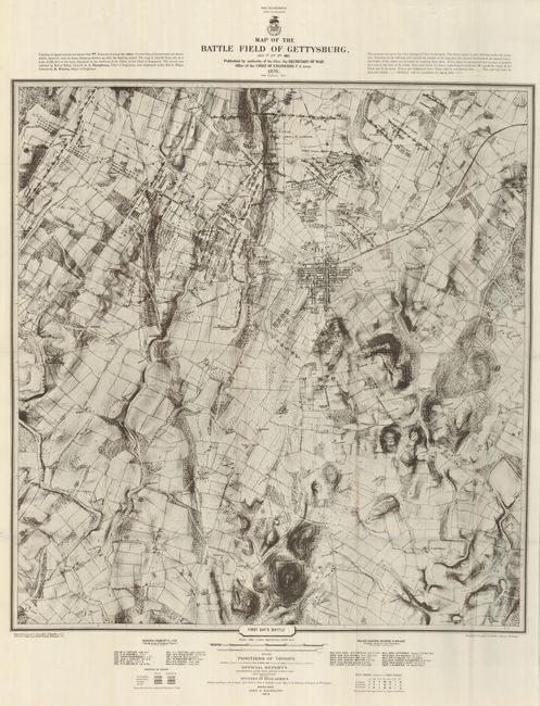
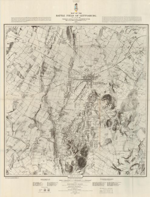
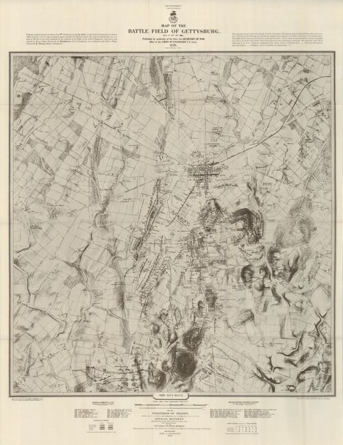
These maps are reprints of the remarkable Civil War battlefield maps first published in 1876. The maps are subtitled First Day's Battle, Second Day's Battle, and Third Day's Battle. The 1876 versions were reduced from one drawn in 1863 that is in the Archives of the Chief of Engineers. The survey was ordered by Brevet Major General A. A. Humphreys, Chief of Engineers, and conducted under Brevet Major General G. K. Warren, Major of Engineers. The troop positions on the maps were compiled and added by John Badger Bachelder (Boston, MA) for the 1876 edition. These are extremely detailed topographic maps with spot elevations and contours for every change of 4 feet in elevation. Details drainage, vegetation, roads, railroads, fences, houses with names of residents, and a detailed plan of the town of Gettysburg. Notes at upper right indicate that "Every object is represented here as near as possible as it was at the time of the battle." Gives a detailed analysis of the deployment of the various units of both armies. Dotted lines and arrows indicate troop position and movement. This reprint doesn't carry the full clarity of the original, but is still quite legible. This edition was printed by U.S. Lake Survey Detroit Michigan and is not noted in the Stephenson reference.
References:
Condition: A+
Folding, as issued on oilskin paper.