Catalog Archive
Auction 130, Lot 300

"A Diagram of Public Surveys in Oregon", General Land Office
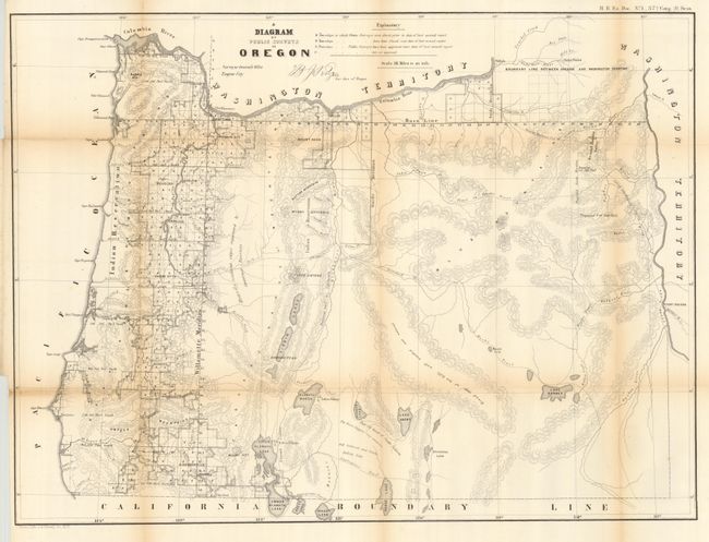
Subject: Oregon

Period: 1862 (published)

Publication: H.R. Doc. No. 1, 37th Cong, 3d Sess.

Color: Black & White

Size:
24 x 18 inches
61 x 45.7 cm
Download High Resolution Image
(or just click on image to launch the Zoom viewer)

An early land office map of Oregon that is signed in the plate by the Surveyor General in Eugene City. It features good detail on a scale of 1 inch to 18 miles and delineates the status of public land surveys in 1862. Locates roads, towns, topography by hachure, major rivers, and the routes of exploration. Delineates and names General Harney's Cutoff, Fremont's Trail, the Immigrant Road, Fort Boisee, Applegates Trail, Meeks Trail, and more. Survey progress is limited to the western valley and Columbia River areas.

References:

Condition: B+

Folded as issued with full margins and sound paper. Some folds with light toning.

Estimate: $140 - $180

Sold for: $70

Closed on 12/2/2009

Archived