Subject: St. Augustine, Florida
Period: 1764 (circa)
Publication: Le Petit Atlas Maritime
Color: Hand Color
Size:
6.5 x 8.3 inches
16.5 x 21.1 cm
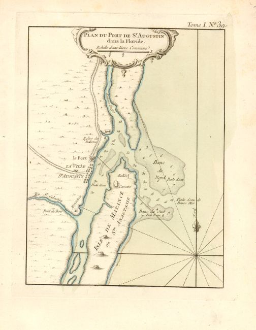
The fortifications of St. Augustine are illustrated on this map with good information on the soundings in the entrance to the harbor. St. Augustine is the oldest European city in the United States. Juan Menendez de Aviles established the first settlement nearly a half century before the first English settlers landed at Jamestown. St. Augustine grew to become the Spanish center of power in North America for almost 200 years. The British gained control of the city in 1763 at about the time of this map's publication. Rhumb lines and a fleur-de-lys orient the map in the blank sea.
References:
Condition: A
Crisp impression, original color and wide original margins. There is some minor toning in the margins.