Catalog Archive
Auction 130, Lot 245

"The "Chevalier" Commercial, Pictorial and Tourist Map of San Francisco from Latest U.S. Gov. and Official Surveys…", Chevalier, August

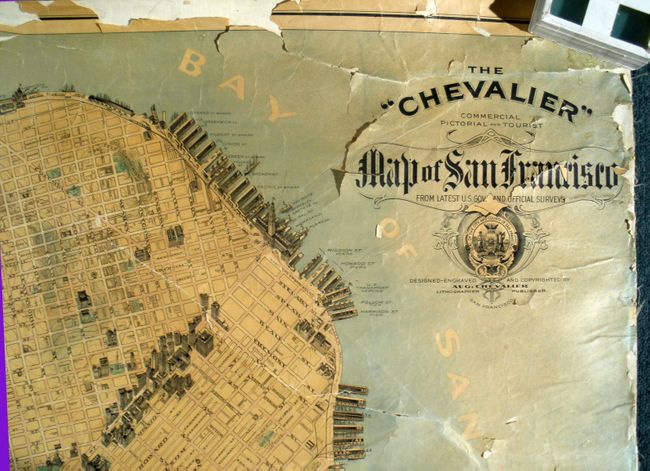
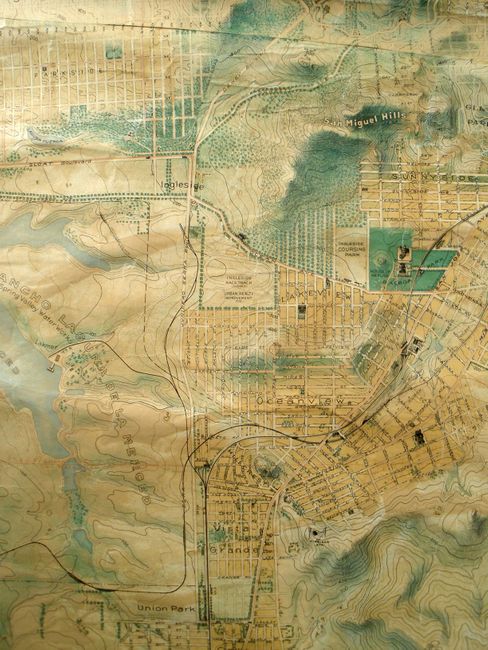
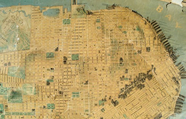
Subject: San Francisco, California

Period: 1903-15 (published)

Publication:

Color: Printed Color

Size:
53.5 x 64 inches
135.9 x 162.6 cm
Download High Resolution Image
(or just click on image to launch the Zoom viewer)

This wall map is the large, rare edition that was published from San Francisco, copyright December 1903. This is certainly the 1915 Panama-Pacific International Exposition edition published to coincide with the event and to graphically portray the amazing rebuilding that had taken place since the earthquake and fire of 1906 that devastated the town, destroying 28,000 buildings. The map is beautifully colored and rendered with all large public and commercial buildings including the waterfront piers being named and drawn in three dimensions to standout from the remainder of the map. Extremely detailed on a scale of 6.5 inch to the mile it locates and names all streets, railroads and parks. Shows the Proposed Twin Peak Tunnel, Golden Gate Park, and the huge Presidio Reservation. Extends to the Pacific Ocean and south to below Union Park and Visitacion with the San Bruno Mountains between. At the south edge of Oceanview is the "Wireless Sta." which was one of the first major wireless stations in the United States. Read more of this interesting story here. At bottom center the map is noted as being the "Improved and Enlarged Edition" and at bottom right is the imprint "Copyrighted 1903 by August Chevalier." The seal of the city of San Francisco is incorporated into the title. A rare map deserving of professional attention.

References:

Condition: D

The inner surfaces of the map are mostly sound and stable, with the occasional tear and paper lifting and several worm holes mostly in the upper right. The sides have lost the original cloth edging so have some chipping with small areas of loss and occasional light stains. Lower margin is a little rough, but the upper edge is in the worst condition with about one third of the upper edge to include the neatline is perished. Both rollers are missing. Professional restoration is recommended to return this rare map to its full potential.

Estimate: $750 - $1,000

Sold for: $1,100

Closed on 12/2/2009

Archived