Subject: Southwestern United States
Period: 1891 (dated)
Publication:
Color: Printed Color
Size:
12 x 20 inches
30.5 x 50.8 cm
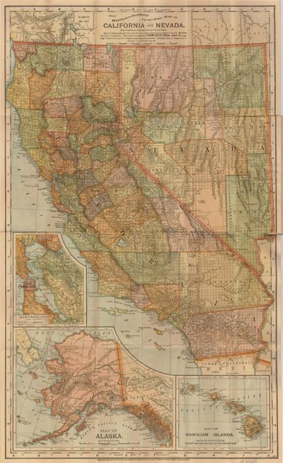
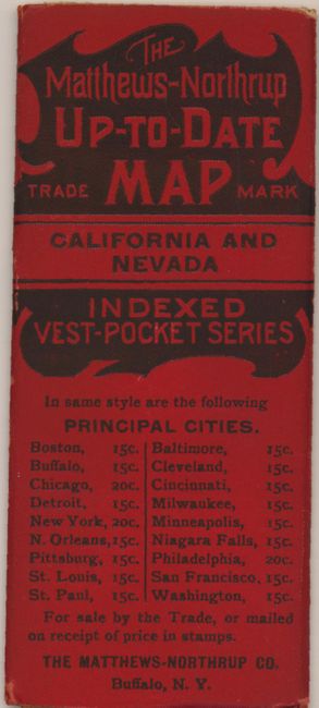
A rarely seen pocket map produced by the same company that created the Century Atlases in the period 1897-1905, with the same remarkably precise engraving and coloring style. It shows the counties, topography, roads, railroads, cities, towns and the progress of the public surveys. There are insets of San Francisco, Hawaii and Alaska. A short history, description and index appears on the verso. The map folds into small red, embossed paper covers (2.2 x 5.3") noting this is part of the "indexed vest-pocket series." This was part of Matthew-Northrup's attempt to compete with Rand, McNally's vest pocket series. Evidently the project was not a commercial success, as these maps are very scarce today.
References:
Condition: B
There are a few short fold separations, and a couple minor tears that have been repaired with archival tape.