Subject: Southwestern United States
Period: 1856-57 (published)
Publication: Atlas of the World
Color: Hand Color
Size:
15.8 x 12.8 inches
40.1 x 32.5 cm
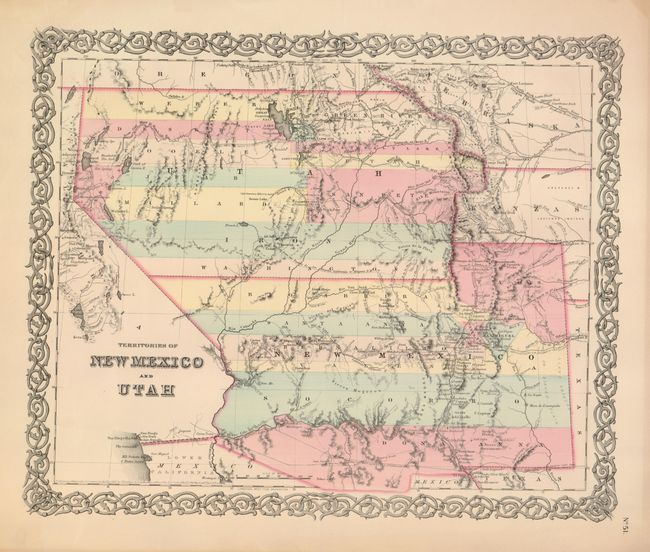
Second state of this very interesting map depicting the region with the largest configurations of the Utah and New Mexico territories. The Utah Territory encompasses all of today's Nevada and extends west to the Continental Divide into present-day Colorado with Fillmore City as it's capital. Nebraska and Kanzas Territories bound Utah on the east. New Mexico Territory includes part of southern Colorado and stretches west to include Arizona and the southern tip of present-day Nevada. Locates Fremont's routes, proposed routes for the Pacific Railroad, the Spanish Trail, and much more. A fine example of a very desirable map that Wheat found important enough to use as the frontis to Volume 4 of his Mapping the Transmississippi West. This is the more desirable edition with decorative borders from the large two volume atlas, dated 1855 and published in 1856-57.
References: Wheat [TMW] #832; Brown, Portolan - Spring 2005 pp. 48-51.
Condition: B+
Very wide margins with original color in pastel shades. The map image is fine, but there is a darker line around outside of margins from prior framing. A few marginal tears or chips in browned lower margin.