Subject: Central United States
Period: 1861-62 (published)
Publication:
Color: Hand Color
Size:
15.5 x 12.5 inches
39.4 x 31.8 cm
This is a handsome pair of early Johnson maps each with his early strapwork border.
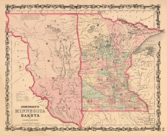
1) Johnson & Browning, 1861. The newly formed Dakota Territory is a huge unorganized area with its western boundary just beyond the Missouri River. Interesting notation locates vast prairies said to be "the great Hunting and Fighting Ground of Dakotah, Odjebwe, Assiniboin, Arikara, Minitarree and other Nations." The proposed Northern route of the Pacific Railroad is shown crossing the Dakota wilderness. Good detail throughout Minnesota, whose county development is already well developed. Pleasantly age toned, one spot. (A)
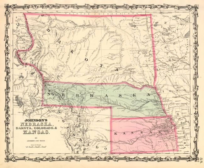
2) Johnson & Ward, 1862. This colorful map features Nebraska with a long panhandle to about present-day Idaho near Ft. Bridger and Fremont's Peak. Above Nebraska is a huge Dakota Territory that extends all the way to the Canadian border, west to the Continental Divide and east to Minnesota Territory. The map is filled with information and locates numerous Indian tribes, trading posts, wagon roads and trails, exploration routes, mountain peaks, and more. It shows the railroad routes explored by Gov. Stephens, Lt. Beckwith, and Capt. Gunnision, numerous forts and early settlements. The Oregon Trail is shown (but not named) and several other emigrant roads are traced including several converging on Denver City. North, Middle, and South Parks, as well as several forts and a few towns are shown in Colorado. Beautiful example. (A+)
References:
Condition:
See individual descriptions.