Subject: Central United States
Period: 1856 (dated)
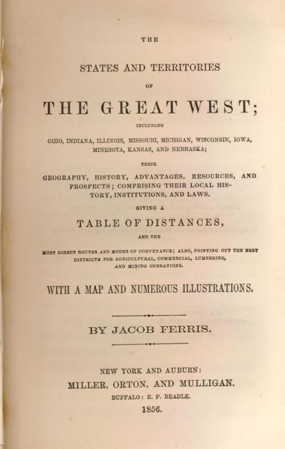
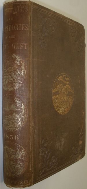
Publication: The States and Territories of the Great West…
Color: Hand Color
Size:
25 x 14.8 inches
63.5 x 37.6 cm
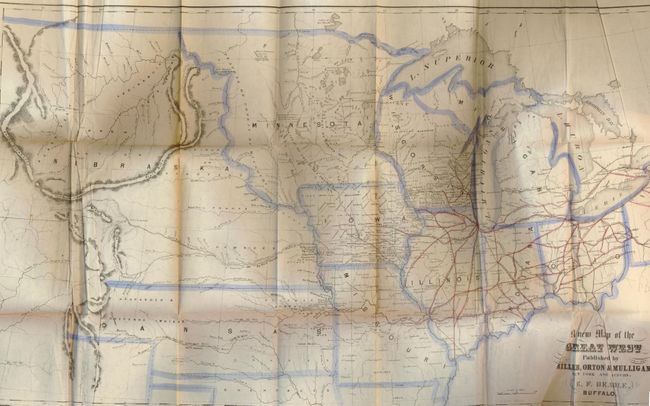
This uncommon map was published by Miller, Orton & Mulligan, New York & Auburn. It was drawn by E. F. Beadle of Buffalo. The map shows all of Ohio, Michigan, Wisconsin, Indiana, Illinois, Missouri, Iowa, the enlarged territories of Minnesota and Kansas, each neatly outlined in blue watercolor. In today's Colorado Denver does not appear, but Canon, Fort St. Vrain, Pueblo and Fort Lancaster are named. It shows the huge, nebulous Nebraska Territory (created in 1854), west of Minnesota and north of Kansas. Kansas extends to the Rocky Mountains and includes the regions allocated to the Arapahos & Cheyennes. The Indian Territory is indicated for the Cherokees. Original red coloring shows railroad detail extending west to Iowa City. The map has fancy titling includes details of watershed, villages and forts, and with rudimentary information on the Rocky Mountains. In the complete volume "The States and Territories of the Great West” by Jacob Ferris." In original brown cloth, octavo, with gilt pictorial stamping on cover and spine. 352 pp., 12 pages ads, plus b&w plates and folding frontis map.
References: Wheat (TMW) #885.
Condition: B
The map has original hand coloring. Some extraneous creasing and some fold toning with two splits. Gutter tear at binding edge. Binding is tight and contents are very good. Covers rubbed, abraded and bumped with small loss at top and bottom of spine.