Subject: South Central United States, Texas and Oklahoma
Period: 1919 (dated)
Publication: Fort Worth Star Telegram
Color: Printed Color
Size:
26 x 35 inches
66 x 88.9 cm
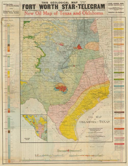
This large and very colorful oil field pocket map covers the entire state to include all of the panhandle, with the western portion in a large inset. This promotional map has bold wood-block printing at top "This Geological Map Distributed by the Fort Worth Star - Telegram Pioneer Oil Newspaper of Texas, 65,000 Daily, Compete - Accurate - Independent." It was published in a supplement to the paper's Sunday business section and is quite rare in any condition. The map itself measures 20"x 27" and is surrounded by colored geological descriptive legend and related text. The large sheet measures 27" x 35". This highly detailed map names all oil fields, the course of early oil pipelines, counties and watershed. Bold color and line identifies seventeen different geological strata. The map represents a remarkable and scarce record of the state of the oil industry just after the close of WWI. This rare pocket map is missing its cover.
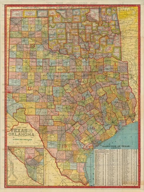
On the verso is "Premier Series Texas And Oklahoma." This huge map (25" x 34") is highly detailed and uses green overprinting to show early "Automobile Roads" in the state. Remarkable detail throughout including towns and small burgs, trails, counties, watershed, railroads, and Congressional districts which are delineated by bold red overprinted lines.
References:
Condition: B+
Bold, strong color. Folding as issued with a few fold intersection splits closed with small pieces of nearly invisible archival tape on the verso of the oil field map.