Subject: Eastern United States
Period: 1825 (published)
Publication: Atlas Geographique, Statistique, Historique ... des Deux Ameriques
Color: Hand Color
Size:
20.8 x 16.8 inches
52.8 x 42.7 cm
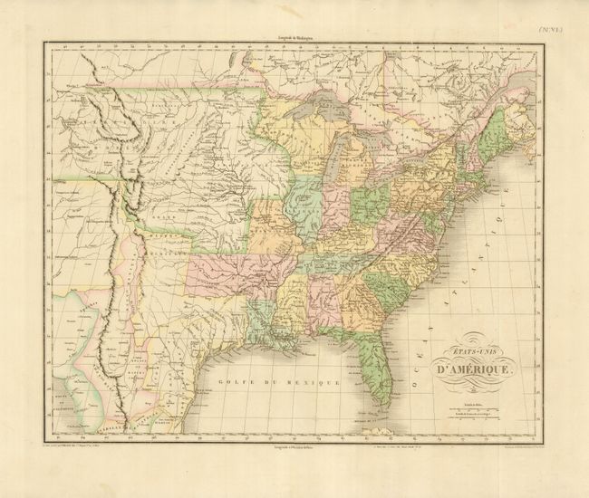
This map was published in the French edition of Carey & Lea's American Atlas. It is directly derived from John Melish's seminal map of the United States. The large Arkansas Territory takes in most of present-day Oklahoma; the new state of Missouri has a vertical western border; Michigan Territory includes most of present-day eastern Wisconsin; and the Northwest Territory takes in present day Wisconsin and Minnesota. The balance of the Midwest is included in the Territoire d'Oregon and is filled with information on numerous Indian tribes. The Grand Desert Americain takes in the southern plains region. Texas is a part of Mexico.
References:
Condition: A
Superb, pastel original color with wide original margins. There are two faint spots near bottom centerfold, still overall very good condition.