Subject: Colonial United States and Canada, Great Lakes
Period: 1730 (circa)
Publication: Atlas Nouveau
Color: Hand Color
Size:
22.5 x 19.3 inches
57.2 x 49 cm
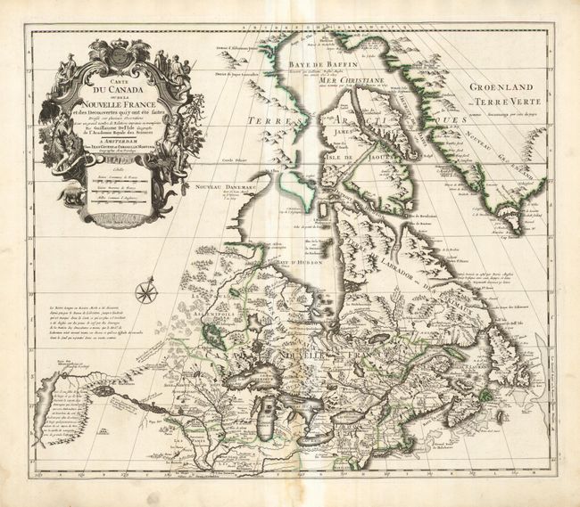
First issued by Guillaume Delisle in 1703, this richly detailed map provides the most accurate rendering of the Great Lakes of the time, with the lakes fully enclosed and properly placed in longitude and latitude. Delisle's map of Canada and the Great Lakes is one of the most outstanding and influential maps of the eighteenth century. It correctly positions the Ohio River but confuses its name with the Wabash River. West of the Mississippi Lahontan's fictitious Riviere Longue is prominently depicted. In Canada special attention is given to the rivers and lakes between Hudson Bay and the St. Lawrence, and Lac de Assenipoils (Lake Winnipeg) connects to Hudson Bay. Sanson's three islands of the Arctic are retained. The exquisite cartouche is decorated with a beaver, natives (one of whom is bearing a scalp), Jesuit explorers and centered with the French crown and coat of arms, which was removed in editions that were issued after the French Revolution.
References: Kershaw #318; Tooley (Amer) p. 20, #39.
Condition: B+
The map has a strong, dark impression on a full sheet with wide margins and a text-based watermark. Centerfold toned.