Subject: Canada
Period: 1857 (published)
Publication: Canada Directory
Color: Hand Color
Size:
33.5 x 22.4 inches
85.1 x 56.9 cm
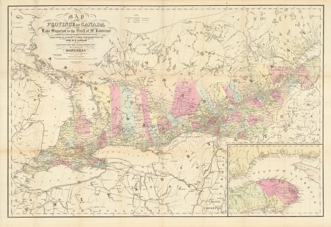
This large and colorful map shows much detail of the region with a large inset depicting the vicinity the Gulf of St. Lawrence. Includes all of Lakes Superior and Erie. The map is corrected from information by the Geological Survey under the Direction of Sir W.E. Logan. Remarkable detail throughout including political divisions, railroads, roads, watershed, towns and villages, etc. Scale 1 inch = 25 miles. A legend explains symbols used to indicate railroads completed, in progress, and those projected. Prepared for the Canada Directory by Thomas C. Keefer, Montreal. An uncommon map.
References:
Condition: B+
Full margins and original hand coloring. Folding as issued with a small area of toning at fold intersection and a small split at another intersection.