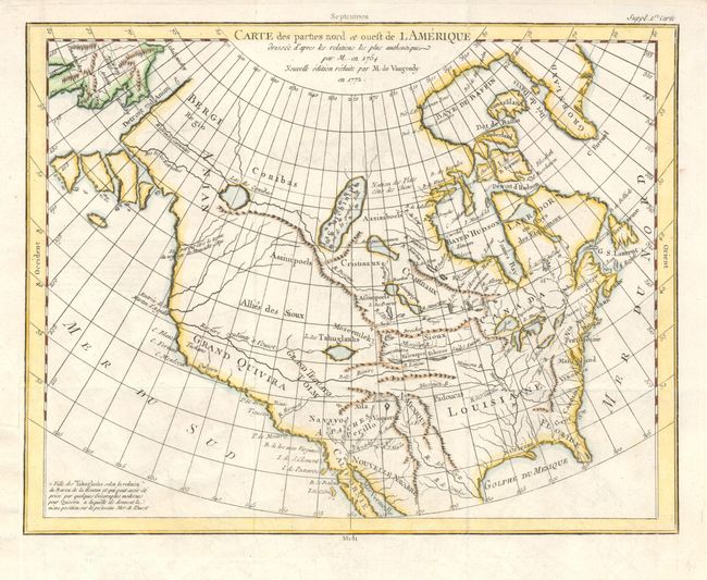
Subject: North America
Period: 1772 (dated)
Publication:
Color: Hand Color
Size:
15 x 11.5 inches
38.1 x 29.2 cm
Robert De Vaugondy's rendition of Samuel Engel's map of 1764 with the Asian and American coasts slightly altered. The myth of a Northwest Passage continues to persist, here linking the Detroit d Anian with Lac Michinipi by a system of rivers and a large Lac des Conibas. There is also a River of the West that connects to another large lake, L. des Tahuglanuks that is located near a remnant of Lanhotan's R. Longue. Alaska is shown as a series of large islands. California is labeled Grand Quivira.
References: Pedley #453; Portinaro & Knirsch #155.
Condition: A
Very faint offsetting, else fine. Binding trim replaced to better accommodate framing. Fine later hand coloring, dark impression and full margins.