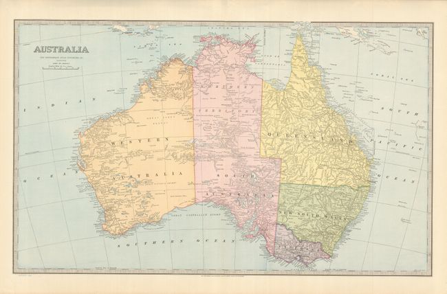
Subject: Australia
Period: 1886 (dated)
Publication: Picturesque Atlas of Australia
Color: Printed Color
Size:
24 x 14.5 inches
61 x 36.8 cm
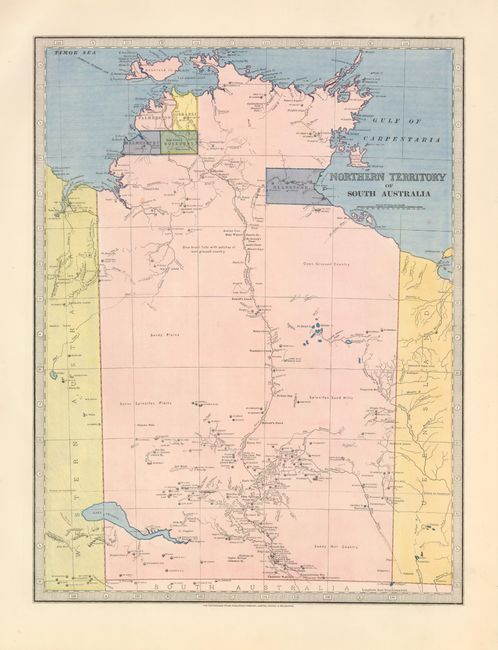
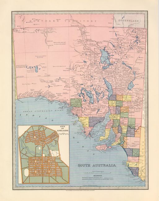
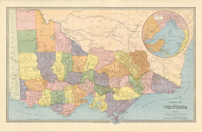
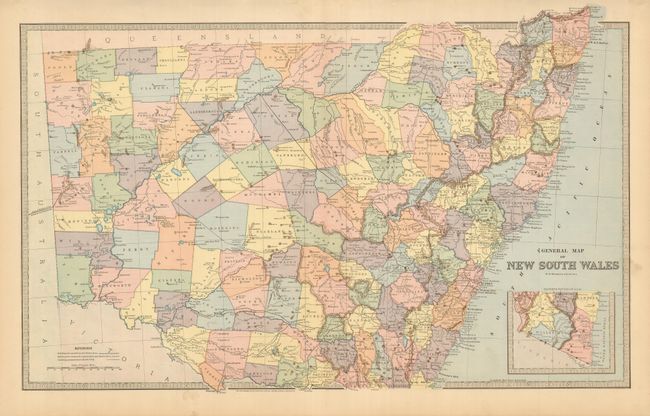
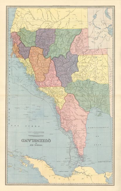
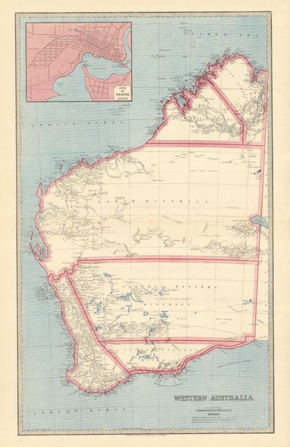
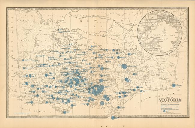
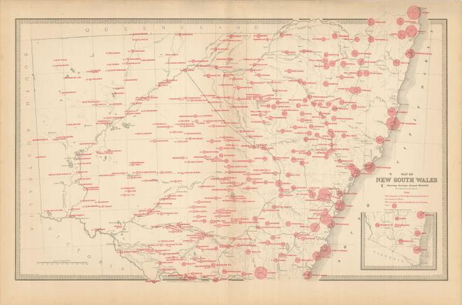
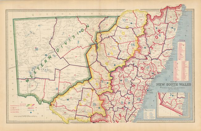
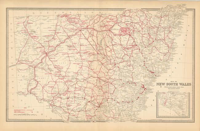
Lot consists of nine double-page and two full-page maps. The seven geo-political maps are Australia; Northern Territory of South Australia (11 x 14.5"); South Australia (11 x 14.5"); Victoria; New South Wales; Queensland and Western Australia. The other four maps are thematic: two display the annual rainfall in Victoria and New South Wales with varying sized circles. The last two thematic maps cover New South Wales detailing the land districts, stock information, wells, and "Trucking Stations." Within the maps are insets of several city plans including Port Phillip Bay and Surroundings; City of Adelaide; and City of Perth. These uncommon Australian produced maps were printed in Sydney and Melbourne.
References:
Condition: A+