Catalog Archive
Auction 129, Lot 762
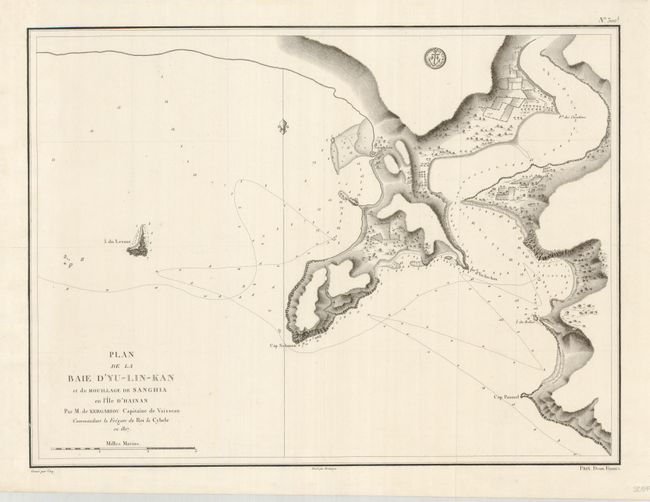
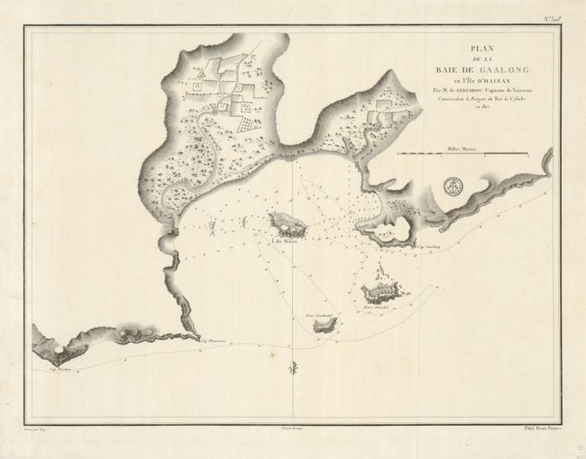
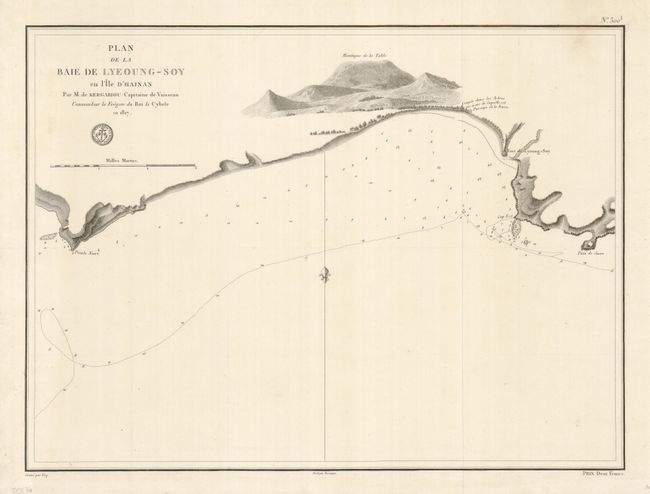
"[Lot of 3] Plan de la Baie d'Yu-Lin-Kan et du Mouillage de Sanghia [with] Plan de la Baie de Gaalong en l'Ile d'Hainan [and] Plan de la Baie de Lyeoung-Soy en l'Ile d'Hainan", Depot de la Marine
Subject: China
Period: 1817 (dated)
Publication: Hydrographie Francaise
Color: Black & White
Size:
22.5 x 16.8 inches
57.2 x 42.7 cm
Download High Resolution Image
(or just click on image to launch the Zoom viewer)
(or just click on image to launch the Zoom viewer)