Subject: Caucasus
Period: 1730 (published)
Publication: Claudii Ptolemaei's Atlas Tabulae geographicae Orbis Terrarum
Color: Hand Color
Size:
18 x 14 inches
45.7 x 35.6 cm
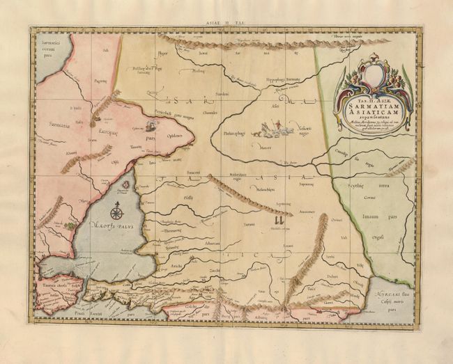
This lovely map covers the region north of the Black and Caspian Seas as far as the Hyperborie Montes. An illustration of the Alexandrii Columne is featured near the center of the map and a group of shepherds are shown with their flock. Mercator originally published this map in his 1578 edition of Ptolemy's great Geography. Although he is most renowned today for the projection he popularized and for first using the term Atlas for a collection of maps, he devoted much of his life to his Ptolemaic maps. The maps were beautifully engraved as nearly as possible to their original form and embellished with fine cartouches and cultural scenes.
References: Mickwitz & Miekkavaara (Nordenskiold) #235-8.
Condition: B
There is a small hole in the left side of the map, else very good.