Subject: Asia
Period: 1792 (dated)
Publication: Atlas Geographique et Universel
Color: Hand Color
Size:
23 x 18.5 inches
58.4 x 47 cm
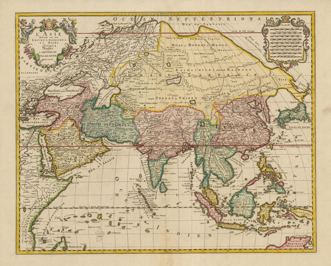
This is an attractive, large map of Asia that includes all of Southeast Asia. The cartography is archaic for the period with the continental outline following the Sanson-Jaillot model. The island of Hokkaido is attached to the mainland as part of the Yupi peninsula and Korea is a long skinny peninsula. The mythical Lake Chiamay is shown as the source of five major rivers in Cochinchine. The decorative title and distance scale cartouches are also very similar to Jaillot's map of 1692.
References: Yeo #208.
Condition: A
Sharp impression and original color with just a hint of toning along fold. There is a tiny old paper repair on the bottom fold, in the blank margin.