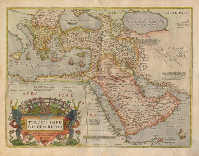
Subject: Turkish Empire
Period: 1574 (circa)
Publication: Theatrum Orbis Terrarum
Color: Hand Color
Size:
19.8 x 14.8 inches
50.3 x 37.6 cm
This is Ortelius' first map of the Turkish Empire that appeared in his monumental atlas only between 1570 and 1579, when the copperplate was replaced with a similar map of the same title. The map is based on Ortelius' own map of Asia, which was derived from the work of Italian mapmaker Giacomo Gastaldi of 1561. It features the Arabian Peninsula prominently and illustrates the coastlines fairly well but most of the interior information is completely hypothetical with many place names taken from antiquity and legend. The Red Sea (Mare de Mecca) is shown relatively accurately whereas the Persian Gulf (Mare Elcatif) is misshapen due to the exaggerated Arabian shoreline. The map is richly embellished with sailing ships, a sea monster in the Black Sea, and a superb, strapwork title cartouche topped by a grape arbor and supported by a pair of female, winged sea monsters. Latin text on verso.
References: Tibbetts #35; Van den Broecke #168.
Condition: B+
There is an old paper repair on a small tear on the lower centerfold. There are some edge tears with a variety of tape repairs on verso, none affecting map.