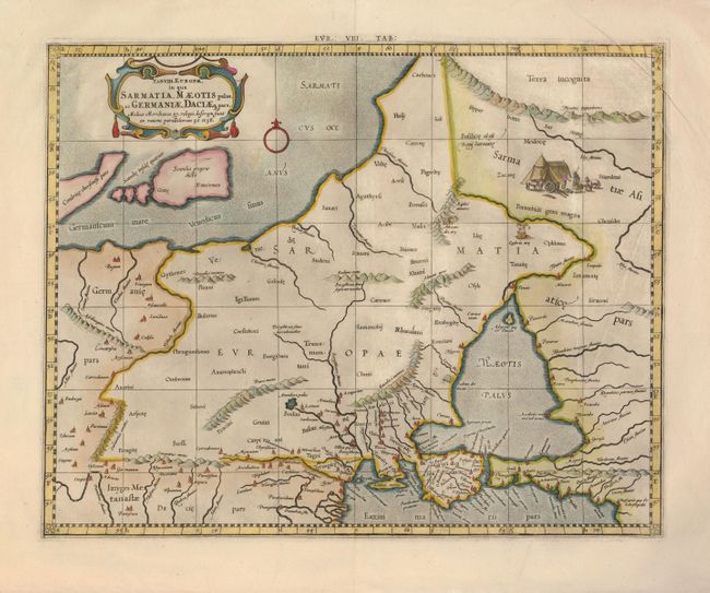
Subject: Eastern Europe
Period: 1695 (circa)
Publication: Claudii Ptolemaei's Atlas Tabulae geographicae Orbis Terrarum
Color: Hand Color
Size:
16.7 x 13.3 inches
42.4 x 33.8 cm
A crisply engraved Ptolemaic map covering the region from the Vistula River eastward, includes the Sea of Azov and the Baltic Sea. Engraved with rope-like mountains, ancient place names and a nomadic group pictured in the Asiatic part of Sarmatia (present-day Russia). Mercator originally published this map in his 1578 edition of Ptolemy's great Geography. Although he is most renowned today for the projection he popularized and for first using the term Atlas for a collection of maps, he devoted much of his life to his Ptolemaic maps. The maps were beautifully engraved as nearly as possible to their original form and embellished with fine cartouches.
References:
Condition: A
There is a professional repair on the upper centerfold and a few minor creases.