Catalog Archive
Auction 129, Lot 396

"Carte des Antilles Francoises et des Isles Voisines Dresse sur le memoires manuscrits…", Delisle, Guillaume

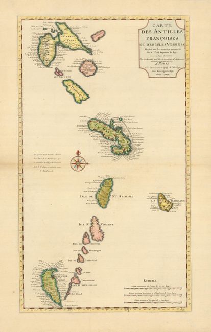
Subject: Lesser Antilles

Period: 1717 (dated)

Publication:

Color: Hand Color

Size:
14.5 x 25 inches
36.8 x 63.5 cm
Download High Resolution Image
(or just click on image to launch the Zoom viewer)

This beautiful chart is the first state of Delisle's map of the Antilles that extends from Guadeloupe to Grenade and includes Barbados. Numerous place names are shown, as are the locations of forts, churches, rivers and more. The most remarkable feature is the upside-down depiction of Grenada. The chart is centered on a large compass rose.

References: Tooley (MCC-33) #54.

Condition: A

Fine old color and a sharp impression. The margins have been slightly trimmed, but are still very ample, with minor repairs of fold separations, well away from the map.

Estimate: $400 - $475

Sold for: $250

Closed on 9/23/2009

Archived