Catalog Archive
Auction 129, Lot 395

"Hayti ou Ile St Domingue. Carte Geographique, Statistique et Historique de Haity", Buchon, Jean Alexandre
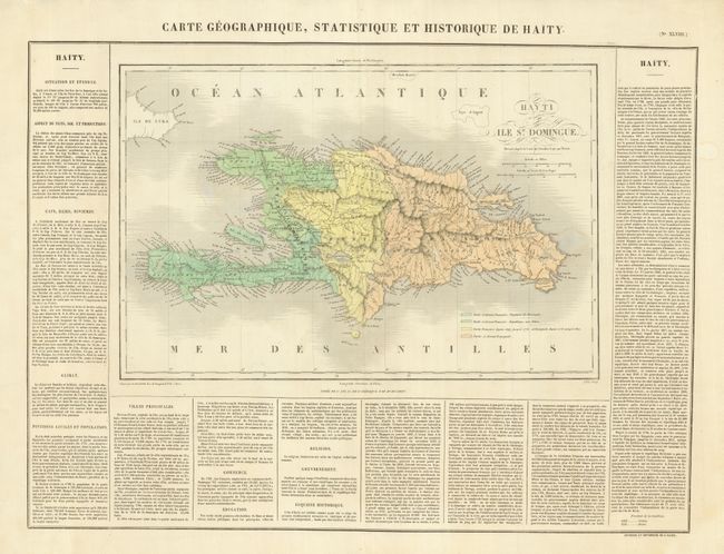
Subject: Hispaniola

Period: 1825 (circa)

Publication: Atlas Geographique, Statistique, Historique et Chronologique…

Color: Hand Color

Size:
17.5 x 12 inches
44.5 x 30.5 cm
Download High Resolution Image
(or just click on image to launch the Zoom viewer)

This large and detailed map of Hispaniola shows settlements, roads and topography. On three sides, French text describes the religious, commercial, historical and other aspects of life on the island. Overall the full sheet measures 27 x 21". The map was originally engraved for Carey and Lea's American Atlas; this is the French version issued in Atlas Geographique. Buchon's atlas was printed on better quality paper than the Philadelphia issue and the maps are generally found in much better condition.

References:

Condition: A

Beautiful example with no flaws in map or text. Two short marginal tears at top. Clean and bright example.

Estimate: $200 - $250

Unsold

Closed on 9/23/2009

Archived