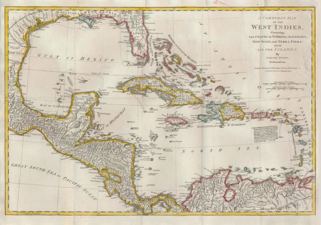
Subject: Gulf of Mexico and Caribbean
Period: 1774 (dated)
Publication: West India Atlas
Color: Hand Color
Size:
17.5 x 11.8 inches
44.5 x 30 cm
This scarce map was included in Sayer & Bennett's famous American Military Pocket Atlas better known as the Holster Atlas and originally folded to 6" x 4" to fit in the diminutive atlas. The map shows information on coastal features and limited interior detail including watershed and larger towns. It extends to include an interesting depiction of Florida and south to show the northern portion of South America. The area of today's Belize is labeled Logwood Cutters referring to the British cutting of logwood, greatly valued in Europe as the principal dyestuff for the expanding wool industry. By the 1770s, mahogany replaced logwood as the main export from Belize. The map carries a notation explaining how the Windward and Leeward Islands came to be known. The map was drawn by Samuel Dunn and "Printed for Rob't Sayer ... 1774."
References: Sellers & Van Ee #1697.
Condition: A
Issued folding, now flattened and professionally backed.