Subject: Southwestern United States, California and Mexico
Period: 1798 (dated)
Publication: Nuovo Atlante Geografico Universale
Color: Hand Color
Size:
13.5 x 18.5 inches
34.3 x 47 cm
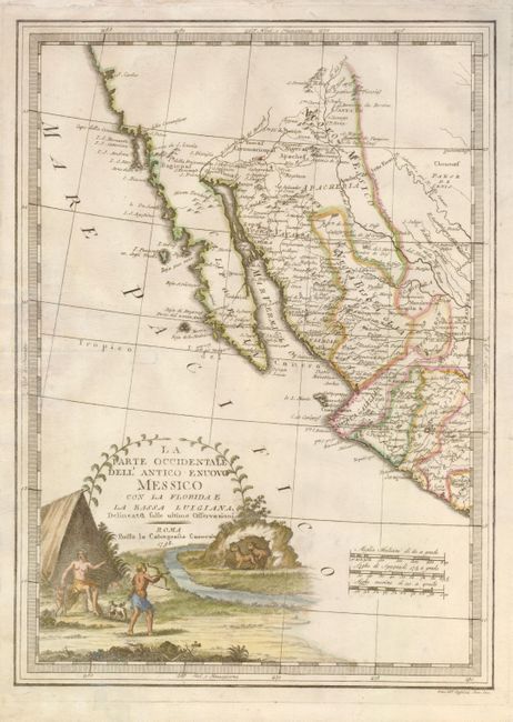
A striking pictorial cartouche, featuring a Native American family defending themselves from a pair of leopards, makes this one of the most attractive 18th century maps of this region. The map covers California, Arizona, New Mexico, part of Texas, Baja California and Mexico. The headwaters of the Rio Grande are in the northern extent of the map with many of the Hopi Pueblos located. The Colorado is shown, with the Gila River (Hila F) more or less properly delineated. Numerous Indian tribes are located including the Yuma, Coco Maricopa and Apache. San Diego and the Channel Islands are shown and a large bay in northern California is labeled S. Carlos (San Francisco Bay?). The map is filled with place names, including many of the missions in the Southwest and S. Antonio Besar in Texas.
References:
Condition: B+
The centerfold has been reinforced with light Japanese tissue. There are some faint brown ink notations on the Mexican coast and in the right margin.