Subject: New York
Period: 1834 (circa)
Publication:
Color: Hand Color
Size:
22 x 8.3 inches
55.9 x 21.1 cm
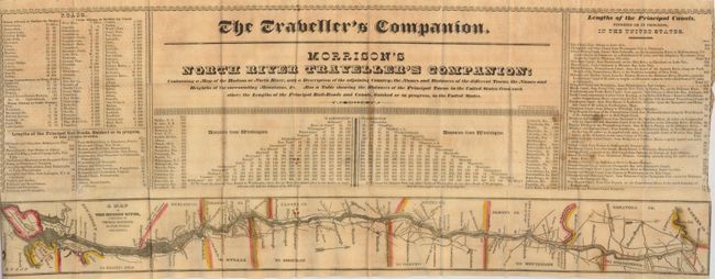
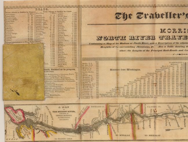
This rare pocket map was published by Thomas Morrison, 175 Pine Street, Philadelphia. The sheet has text at either side, title above, central panel of Distances from Washington. Across the bottom is the strip map "A Map of the Hudson River" (22" x 2.3"), which details the river from its mouth at New York and the Narrows, north to Glenville in Warren County. The panel at right lists 29 canals, finished or in progress, with lengths given. The Erie Canal is the longest at 363 miles. The table at left names 24 railroads, finished or in progress. The longest is the famous Baltimore & Ohio at 250 miles. The map folds into paper-covered boards, 3.5" x 2.5". The OCLC locates only five institutional holders and we find only one past sales record. Printed by C.A. Elliott, Philadelphia. Printed on thin banknote quality paper.
References:
Condition: B
A few spots and some fold intersection splits, one with a small loss to paper. The side margins have been trimmed slightly into the border, as issued by the maker. The original boards are without label.