Subject: Michigan
Period: 1836 (dated)
Publication:
Color: Hand Color
Size:
10.5 x 12 inches
26.7 x 30.5 cm
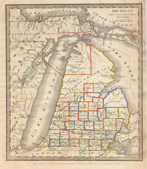
This is the rare, early edition by Burr himself. The narrow, backward sloping configuration for Lake Michigan is from Aaron Arrowsmith's map of 1802. The upper regions are not organized but are loosely arranged into the Ottawas & Miamies area, and the Township of Michillimacinac which is part of the Upper Peninsula called Michillimacinac County. To the south 37 counties are delineated, named and featured in outline color. Michigan's claimed southern boundary extends to nearly the southern tip of Lake Michigan. The mapping of Petite and Grand Traverse Bays is early and very rudimentary.
References: Karpinski. (MI) 111; Karrow, R.W. (Mid West) 5-1968; Phillips, P.L. (Atlases) 771-44.
Condition: B
The map has fine original color and dark, early impression. The image is fine less an area of brown at upper right just inside border, a few short marginal tears and a spot of mildew in the margin.