Subject: Florida
Period: 1855 (dated)
Publication:
Color: Black & White
Size:
34.5 x 24.5 inches
87.6 x 62.2 cm
The Office of Coast Survey is the oldest U.S. scientific organization, dating from 1807 when Congress directed that a "survey of the coast" be carried out. By 1836, it was called the U.S. Coast Survey and in 1878, the name was changed to the U.S. Coast and Geodetic Survey. Today the Office of Coast Survey is a division of the National Oceanic and Atmospheric Administration NOAA.
The survey teams, composed of civilians as well as Army and Naval officers, charted the nation's waterways and produced a wide array of reports, survey charts, hydrographic studies of tides and currents, astronomical studies and observations, and coastal pilots. These charts are an important record of the changing nature of the nation's coastlines. In additional to coastal charts, the U.S. Coast and Geodetic Survey produced land sketches, Civil War battle maps, and the early aeronautical charts.
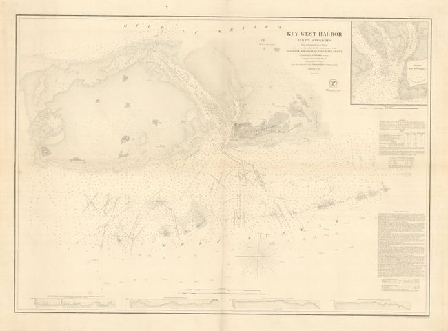
This important sea chart of the Florida Keys includes a large inset map of Key West Harbor and extensive sailing directions. Reproductions of this chart are fairly common in the market; however, the original chart is rarely found on the market - our records indicate only one dealer and one auction record in the past 25 years.
References:
Condition: A
Overall very good, with some minor creases and light soil