Subject: Florida
Period: 1853 (dated)
Publication:
Color: Black & White
Size:
24.8 x 21.8 inches
63 x 55.4 cm
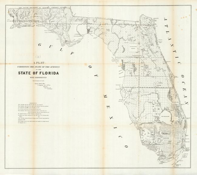
This 1853 edition shows up-to-date survey progress and development in the state. This version shows the entire state to include Key Largo and features the Forbes Purchase and the Arredondo Grant lands. Numerous forts are located including Lauderdale, Howell, Foster, Thompson, Adams, and many more. Key Biscayne is identified; Miami is not yet named, but Fort Dalles is clearly shown. This map was produced in a period of relative peace between the U.S. and Seminole Nation. The third and final Seminole War waged between 1855 and 1858. Extensive legend gives survey status for townships. From the Surveyors Office in St. Augustine, September 30th, 1853 by John Wescott, Surveyor General.
References:
Condition: B+
Minor toning on folds with a couple very tiny fold intersection splits and a few spots of foxing. A couple of the folds are separated in the blank margins. Overall better condition than most government report maps from this period.