Subject: District of Columbia
Period: 1865-95 (circa)
Publication: Official Atlas of the Civil War
Color: Printed Color
Size:
13 x 16.3 inches
33 x 41.4 cm
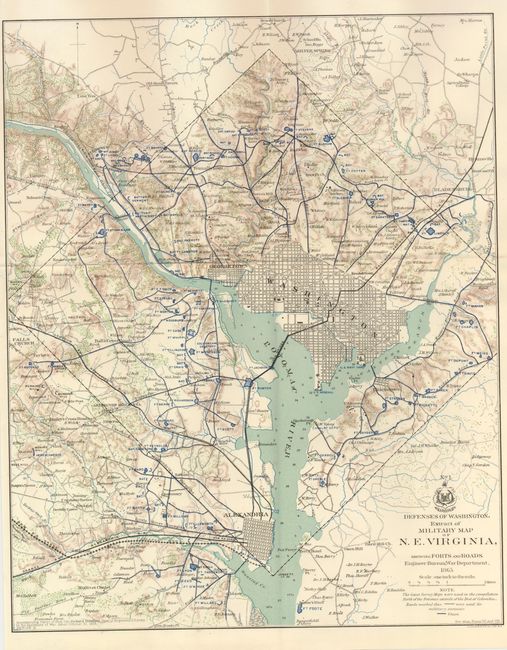
This interesting and historical map details the various defenses poised to defend Washington from the Confederate Army during the Civil War. The map extends to include Alexandria, Falls Church, Silver Spring and Bladensburg. With remarkable detail, the map locates forts, schools, mills, railroads, fortifications, and much more. There are scores of individual homes and farms identified with the owner's name. Washington is shown in street grid format. There is fine detail of watershed and topography. Dated 1865, but published 1891-95. Blank verso. The map was published to accompany the "report of Brig. Gen. Richard Delafield…dated October 30, 1865." This is one of the more desirable maps from the report.
References:
Condition: A+
Mint, flawless condition. These maps are often found on toned, brittle paper but this example is on bright, sound paper with no flaws.