Subject: Connecticut
Period: 1869 (dated)
Publication:
Color: Hand Color
Size:
15.5 x 12.8 inches
39.4 x 32.5 cm
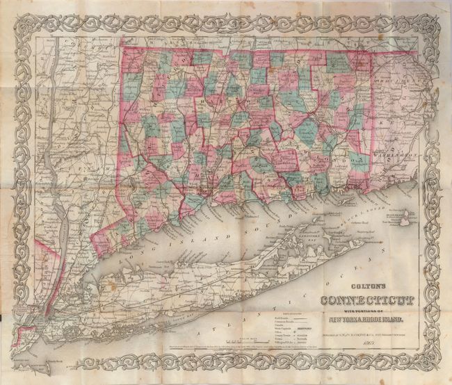
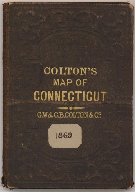
This finely engraved pocket map appears to be identical to Colton's atlas map except it is printed on fine banknote-style paper. The map individually colors each county and locates and names all railroads and canals. The legend further locates Cities, County Towns, Villages and Post Offices. It extends to Jersey City and includes all of Long Island. Surrounded by Colton's fancy scroll border. The map folds into gilt-stamped cloth covers (3.5 x 5") titled "Colton's Map of Connecticut" with a hand written paper label bearing the date 1869. Inside front cover has original paper label listing other maps for sale by the G.W. & C.B. Colton firm.
References:
Condition: B+
Some fold intersection splits have old tape repairs on verso. Covers slightly rubbed with a small raised band through middle.