Subject: Colonial New England
Period: 1776 (published)
Publication: Gentleman's Magazine
Color: Black & White
Size:
9 x 6.8 inches
22.9 x 17.3 cm
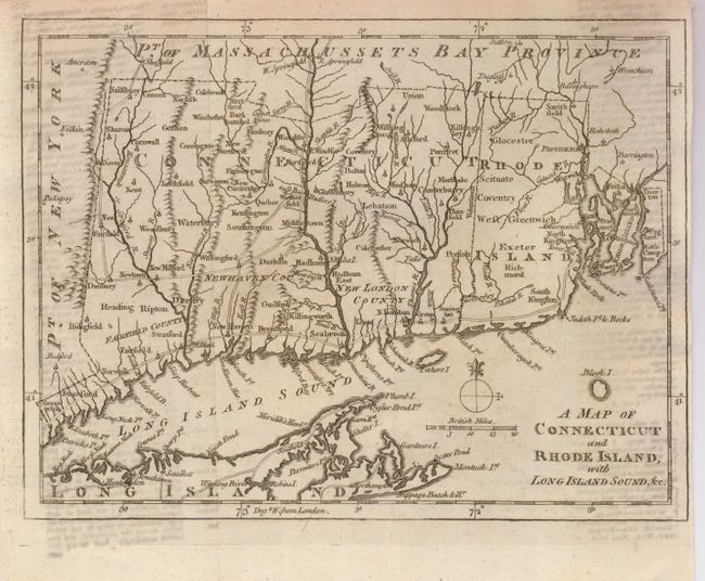
This Revolutionary War period map has good detail of early settlements including roads, villages and ports; locates New London, Groton, Stanford, Norwalk, New Haven, Seabrook, etc. The counties in Connecticut are Fairfield, New Haven and New London. There is a copper mine near Simsbury, CT. Includes a portion of eastern Long Island from Hog Neck to Montuck Point, noting villages and roads. This is the last of a series of four maps issued in the Gentleman’s Magazine during 1776 to illustrate the growing unrest in the colonies.
References: Jolly: GENT-249; Sellers & van Ee #819; Thompson #25.
Condition: B+
Dark impression on thick hand laid paper. A little text offsetting at lower right.