Subject: Eastern United States
Period: 1801 (dated)
Publication:
Color: Hand Color
Size:
9.4 x 7.8 inches
23.9 x 19.8 cm
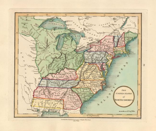
This early map of the young United States is filled with great information on the early roads and settlements. The map covers from the District of Main through the northern portion of Florida and west to beyond the Mississippi River. To the northwest of the states is the huge Indian Territory with many tribes named plus Lead Mines and several forts located. Georgia and West Florida extend fully to the Mississippi River. Georgia is in an uncommon configuration with West Florida occupying the southwest portion of the state from about 85° latitude.
References:
Condition: A+
Beautiful, dark impression and fine hand coloring on a thick sheet with wide margins.