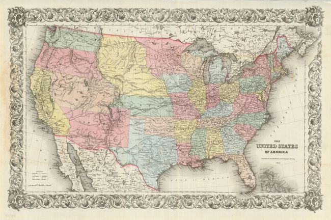
Subject: United States
Period: 1855 (dated)
Publication:
Color: Hand Color
Size:
26.5 x 17.5 inches
67.3 x 44.5 cm
This great map features numerous early western territorial boundaries. Washington and Oregon Territories extend to the huge Nebraska Territory at the continental divide. Nebraska Territory in turn, extends to the Missouri River where it borders a large Minnesota Territory. Utah Territory spans from California east to join Nebraska and Kanzas along the Rocky Mountains and continental divide. The very large New Mexico Territory comprises all of today's Arizona, the southern tip of Nevada, and part of Colorado. The map details the exploration routes of many expeditions including those of Marcy, Kearny, Fremont, etc., and locates the Santa Fe Trail and the Oregon Trail. An uncommon issue printed on bank-note paper and surrounded in a flourishing decorative border.
References:
Condition: A
Issued folded, now flattened. There are a few light, insignificants spots, overall very good.