Subject: Atlases
Period: 1856 (dated)
Publication:
Color: Hand Color
Size:
13.5 x 19 inches
34.3 x 48.3 cm
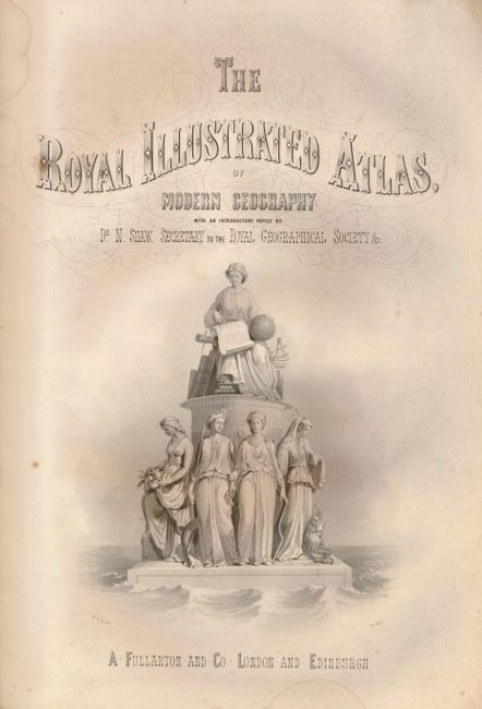
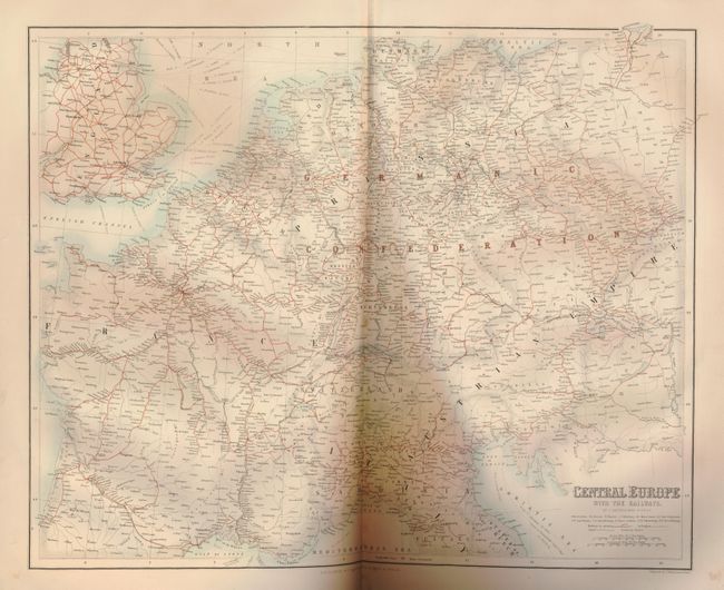
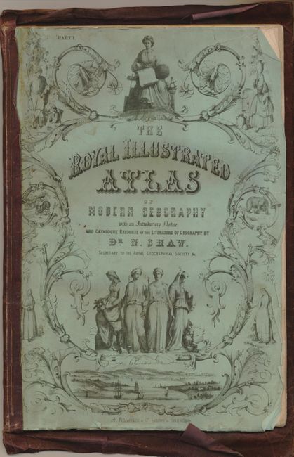
This set of maps is "Part I. The Royal Illustrated Atlas…" and is still in the original green paper mail cover. Atlases were often mailed to subscribers in small portions as the maps became available. When all of the parts were collected they were taken for binding into a complete atlas, where the paper mailing covers were discarded and are rarely seen today. Also contains the green paper introduction page which informs the subscriber that when finished the atlas "will contain in all upwards of One Hundred Maps, engraved in the first style of art" and will be mailed in "26 Parts at 5s. each." The page continues "The ordinary Parts will contain at least 4 Maps, two general and two (or more if Plans) sectional, with pictorial Illustration on the latter…" This group of maps includes the illustrated title page, List and Order of Arrangement, and fourteen single and double page maps. These highly decorative and illustrated maps are by G.H. Swanston and J. Bartholomew. The double page maps measure approximately 21 x 17". The folio pages and maps are fronted with the green mailing sheets and crudely bound and stitched in old brown cloth.
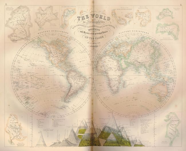
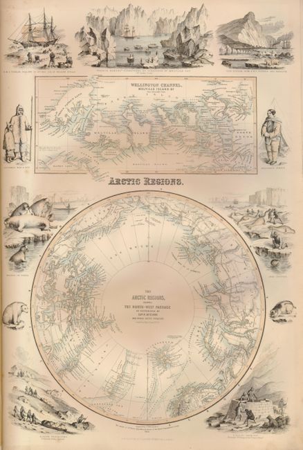
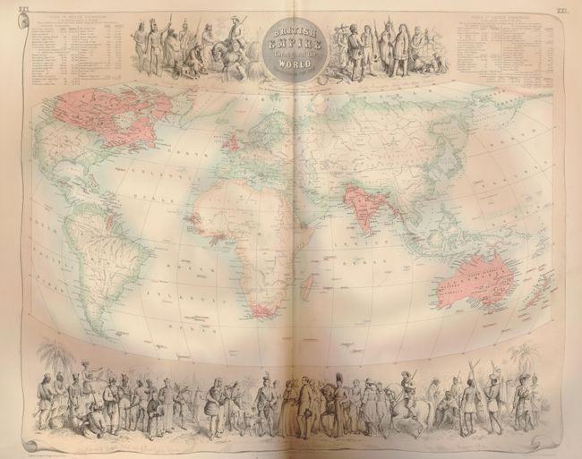
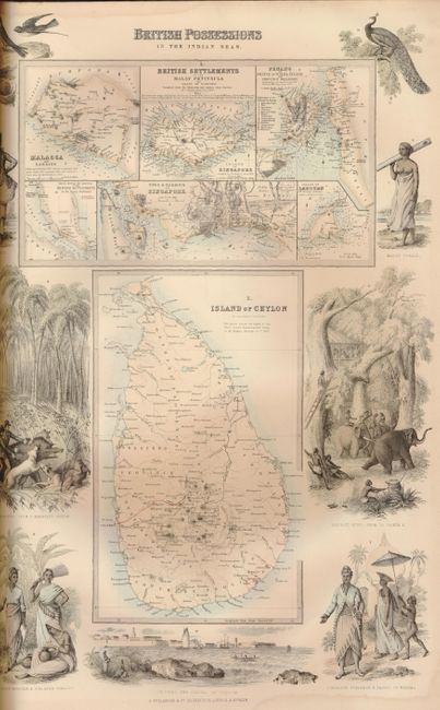
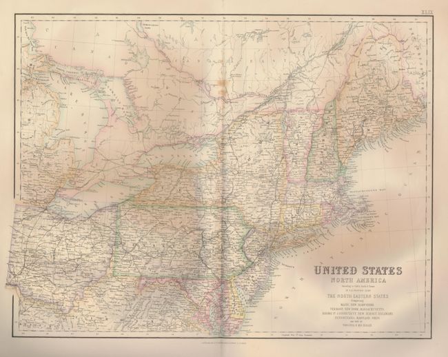
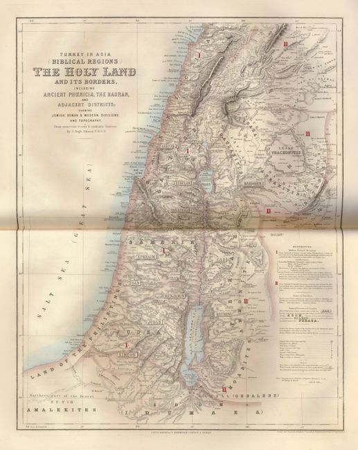
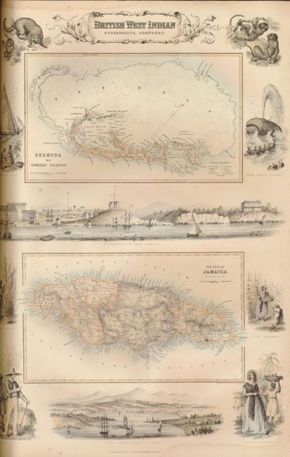
The maps include: The World in Hemispheres with Comparative Views of the Heights of the Principal Mountains and Basins of the principal Rivers on the Globe, by G.H. Swanson (double page); Arctic Regions; Central Europe with the Railways; States of the German Confederation (dp); British Empire Throughout the World Exhibited in One View (dp); England & Wales (dp); Ports and Harbours on the South East Coast of England; Ports and Harbours on the South-West Coast of England & Wales; Ports and Harbours on the West Coast of Scotland; Ireland (dp); British West Indian Possessions, Northern; British Possessions in the Indian Seas; Australia and New Zealand (dp); Turkey in Asia (Biblical Lands) The Hold Land and its Borders, including Ancient Phoenicia, the Hauran, and Adjacent Districts showing Jewish, Roman & Modern Divisions and Topography (dp); United States North America According to Calvin, Smith & Tanner…North Eastern Sheet Comprising Maine, New Hampshire, Vermont, New York, Massachusetts, Rhode Id., Connecticut, New Jersey, Delaware, Pennsylvania, Maryland, Ohio. And Part of Virginia & Michigan; and South Africa From Official & other authentic Authorities. Should be considered a set of maps.
References:
Condition: B+
Maps generally good+ to very good.