Subject: Atlases
Period: 1855-56 (published)
Publication:
Color: Hand Color
Size:
16.5 x 19 inches
41.9 x 48.3 cm
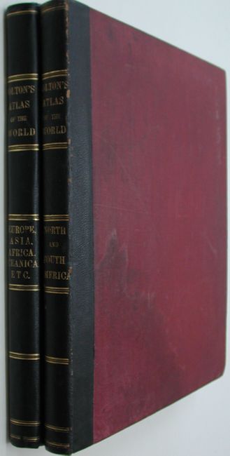
This complete, matching two volume folio atlas contains two engraved frontispieces and 103 maps, each with Colton's decorative strapwork border. First edition with red cloth binding and quarter leather with gilt banding and title on spine. Both volumes with frontispiece, title pages, list of maps, text and tables.
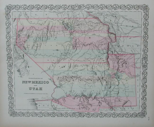
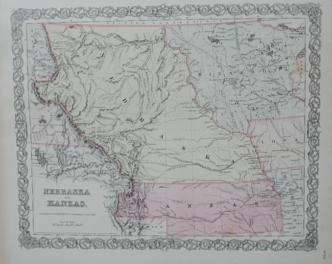
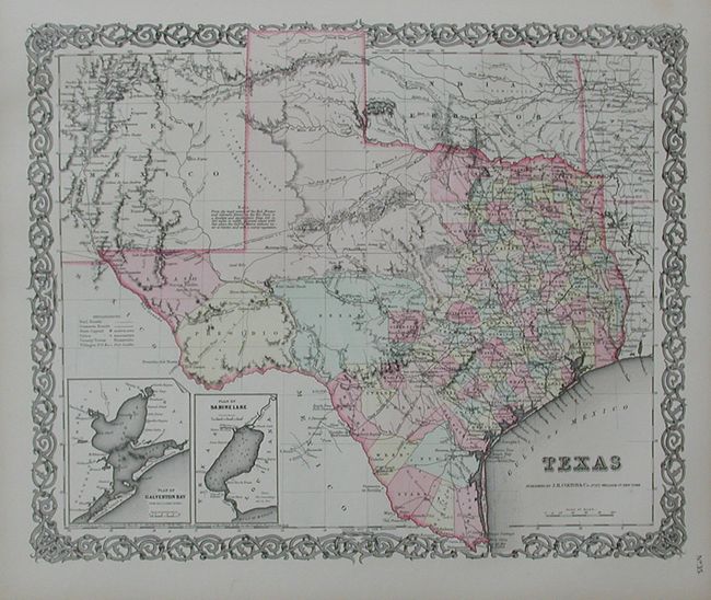
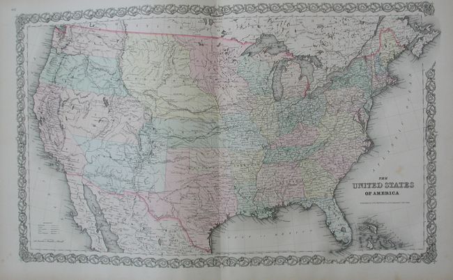
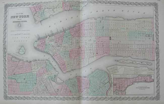
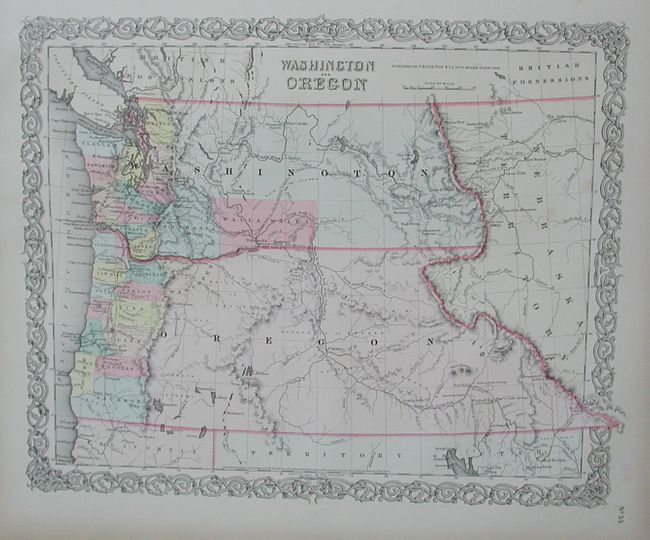
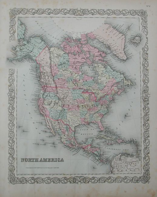
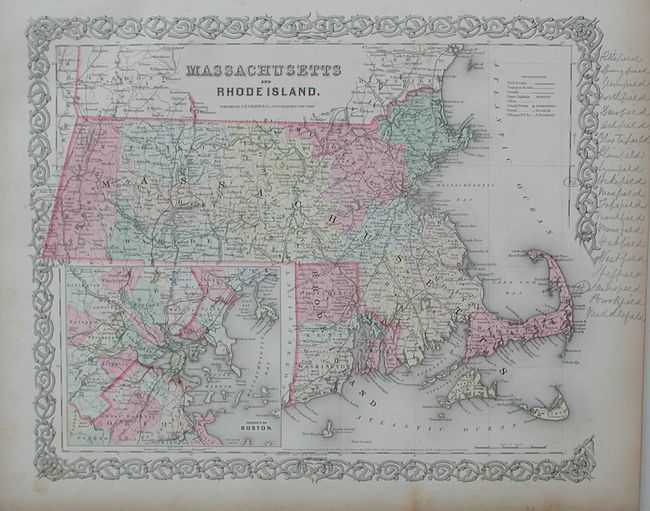
Volume I contains maps concentrating on the Western Hemisphere. 44 sheets relate to the United States, displaying 64 maps, with numerous sought after single-page state maps - many with city insets. Many of the maps contain fascinating and early western borders. With many great maps including: the U.S. map features Kanzas the map of Texas features early county configurations; the early map of Minnesota shows its border to the Missouri River. Also present is the most desirable Nebraska and Kanzas map which depicts Nebraska stretching from Kansas to the Canadian border and bounded on the side by Washington and Oregon at the Continental Divide and Minnesota on the east. Also with the maps of the Territories of New Mexico and Utah, the California map with the large inset of San Francisco, and the Territories of Washington and Oregon with their eastern boundaries on the Continental Divide and county development limited to the coastal areas. City plans included in Volume I are Montreal, Boston, New York (double-page), Philadelphia, Baltimore, Washington, Richmond, Norfolk/Portsmouth, Savannah/ Charleston, Louisville/New Orleans, Pittsburgh/Cincinnati, St. Louis/Chicago, Panama, Havana, Lima, Rio Janeiro, Pernambuco. This edition has the frontispiece showing Native American Indians overlooking a valley. The NYC map has a clean centerfold split at lower half and Indiana has some marginal soiling.
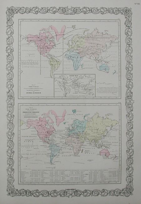
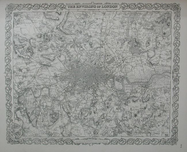
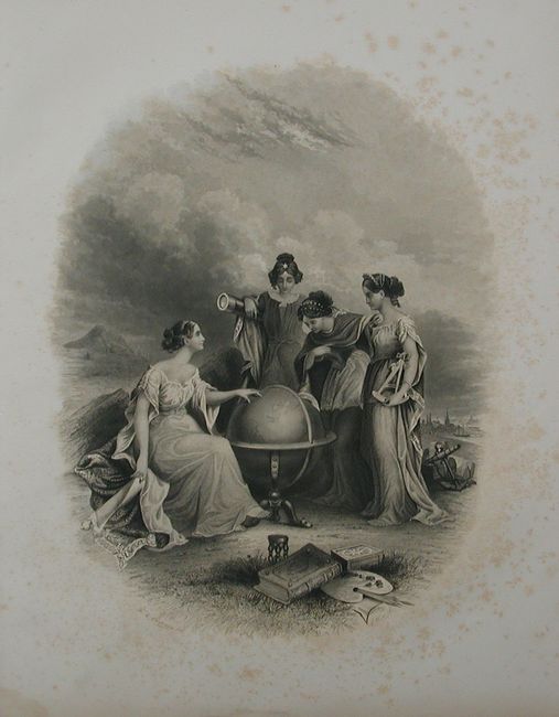
Volume II continues with 42 maps of Europe, the Middle East, Africa, Asia and Oceania. City plans in Volume II include London and Paris (both black and white), Amsterdam, Brussels, Hamburg, Bremen, Vienna, and Hong-Kong. Opposite the title page the frontispiece shows four women studying a large globe turned to the Eastern Hemisphere. Also with the double-page comparative chart illustrating the heights of mountains and lengths of rivers.
References:
Condition: A
Both with narrow line of water stain at bottom of some pages not affecting map images. Most maps very good, but the maps vary B+ to A+. Cover with a little light staining and boards, spines fine. A lovely pair of matching, first edition atlases.