Subject: Western Hemisphere
Period: 1592 (dated)
Publication: Book III Grand Voyages
Color: Hand Color
Size:
17.2 x 14 inches
43.7 x 35.6 cm
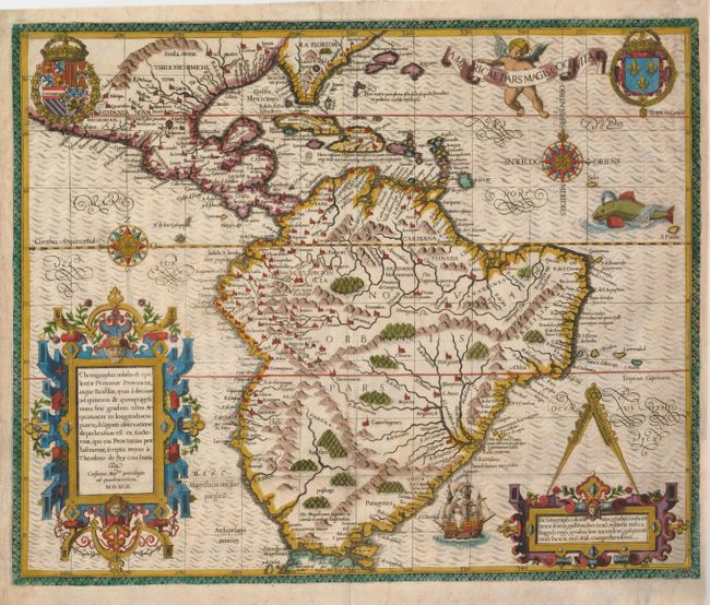
Focusing on the Spanish possessions in the Americas, this map covers what is the present-day southern United States through South America. It was published to accompany the accounts of the voyages of Johann van Stadden and Jean de Lery. The cartography is drawn from de Bry's own map of Florida and the West Indies after Jacques le Moyne. However, there is no easily discernible source for the South American cartography, with its southern regions shown too broad, but not quite bulging as with the Ortelius version. De Bry's extraordinary engraving skill and artful style are very evident with the large elaborate cartouches, coats of arms, two compass roses, sea monster, Spanish galleon and intricate border.
References: Burden #80; Garratt (TMC-9) #G-3.
Condition: C+
Sharp impression with attractive later color. The are some tissue repairs of tiny paper breaks along the folds. Remargined at right and paper restoration in both bottom corners with part of the right border in facsimile.