Subject: Western Hemisphere
Period: 1573 (published)
Publication: Theatrum Orbis Terrarum
Color: Black & White
Size:
20 x 14.5 inches
50.8 x 36.8 cm
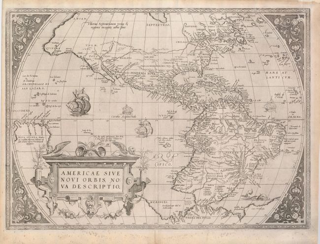
This is one of the most famous maps of America, and one that had enormous influence on the future cartography of the New World. Frans Hogenberg engraved this map, and it is primarily based on Gerard Mercator's great multi-sheet world map of 1569. The most recognizable features of the map are the bulbous Chilean coastline and the exaggerated breadth of the North American continent. In North America a lengthy St. Lawrence River reaches across the continent to nearly meet the fictitious, westward flowing Tiguas Rio. The strategically placed title cartouche hides the unknown South Pacific and therefore most of the conjectural great southern continent, which is shown attached to both New Guinea and Tierra del Fuego. This is from the uncommon first plate (second state), published in the Latin edition of 1573. This plate had a relatively short life and was published only between 1570 and 1573.
References: Burden #39; Van den Broecke #9.
Condition: A
Trimmed but still adequate margins, which have been professionally reinforced on verso with light Japanese tissue. Minor discoloration in bottom margin. Remnants of linen hinges on verso.