Subject: Northwestern Africa
Period: 1541 (published)
Publication: Claudii Ptolemaei Alexandrini Geographicae…
Color: Hand Color
Size:
17.3 x 11 inches
43.9 x 27.9 cm
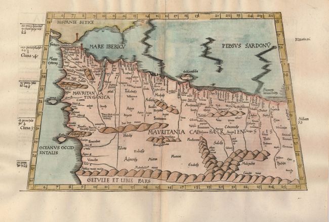
This fine Ptolemaic map is from the wood blocks of Laurent Fries, the famous physician, astrologer and geographer. The map covers northwestern Africa showing the regions that would become Morocco and Algeria and including the Strait of Gibraltar, here called Fretum Herculen. The topography is dominated by large rivers, convoluted mountain ranges and the locations of ancient cities are noted. This edition, printed by Gaspar Trechsel, is a reissue of the 1535 edition, which was printed from the same blocks as those in the 1525 edition. Title is from the verso, which contains Latin text.
References: Mickwitz & Miekkavaara (Nordenskiold) #211-11.
Condition: A
Color is a bit uneven, else very good with wide original margins. Some worming in the blank margins (and a couple of small holes in the map) have been professionally filled and not noticeable unless held up to strong light.