Subject: India
Period: 1724 (circa)
Publication: Oud -En Nieuw-Oost Indien
Color: Hand Color
Size:
23.3 x 20 inches
59.2 x 50.8 cm
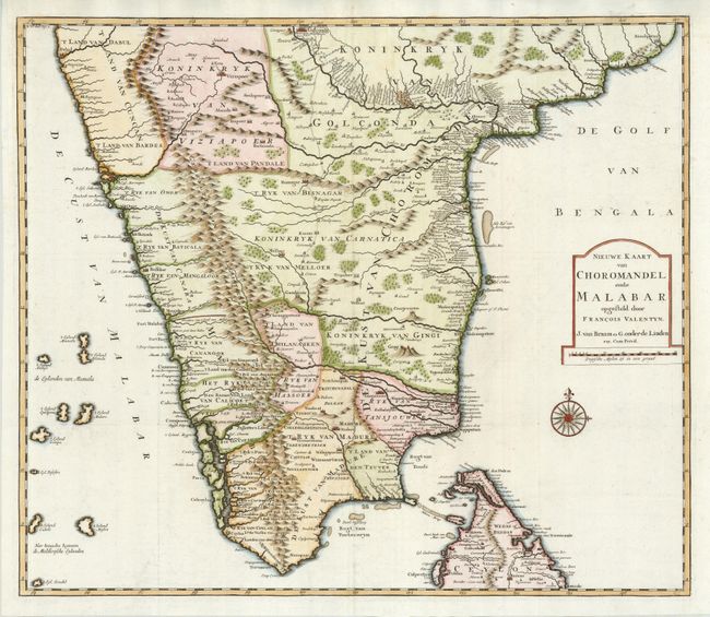
This large, detailed map of southern India covers the region below Goa and Golgonda and includes the northern part of Sri Lanka. There is an incredible amount of information provided along the coastlines and major rivers, including settlements, roads and major cities. The map was published in Francois Valentyn's important travel book and is one of the few early Dutch maps to focus on the region. Valentyn, a Minister of the Dutch Reformed Church, served with the Dutch East India Company. The map was engraved by J. van Braam and G. onder de Linden.
References:
Condition: A+
Issued folded, now flattened with the binding trim at upper left extended to better accommodate framing. The fold intersections are expertly reinforced on verso.