Subject: Korea & Japan
Period: 1752 (dated)
Publication: Histoire du Japon, 2nd Edition
Color: Black & White
Size:
14 x 9.8 inches
35.6 x 24.9 cm
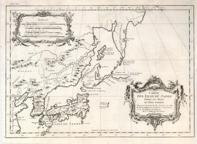
Following his influential map of Japan, here Bellin focuses on a smaller area from the Kamchatka Peninsula continuing south to locate Nagasaki on Kyushu Island, including Korea and a long portion of the Chinese coastline. It details some of Dutchman Vries' discoveries, but it still shows the fictitious "I. Matmanska ou Matsumey" to the north of Terre de Jesso. The Kuril Islands, also discovered by Vries, more accurately appear as a chain up to the tip of Kamchatka. The island "Sagalian Anga Hata" (Sakhalin) lies between Kamchatka and the mainland. Here it is shown too short in the north-south direction because Vries mis-took part of it for Ezo. On the mainland the cities of Peking and Seoul (Sior) are located. Two decorative and large rococo-style cartouches contain the title at lower right and four distance scales at upper left.
References: Walter #82B.
Condition: A
Dark, early impression.