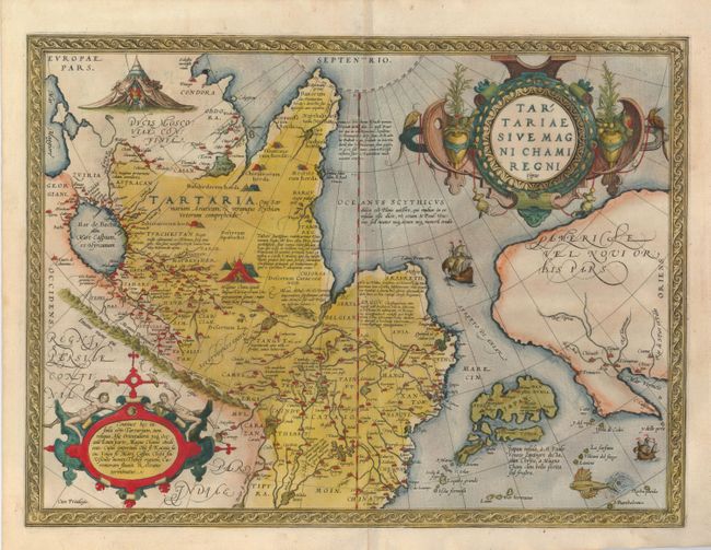
Subject: Northern Asia
Period: 1570-73 (published)
Publication: Theatrum Orbis Terrarum
Color: Hand Color
Size:
18.5 x 13.8 inches
47 x 35.1 cm
This extremely decorative map is the earliest map to focus on the North Pacific and is one of the earliest depictions of Northwestern America. While designed to illustrate the expansive Kingdom of the Great Khan in Asia, its main feature is the Stretto di Anian. Ortelius' depiction increased public awareness of Gastaldi's theory of a strait between the continents of Asia and America. The map covers northern Russia, China, and a very early depiction of Japan, which is located just off the American shore. The map was beautifully engraved by Frans Hogenberg and is filled with decoration including two encampments of Tartars, sailing ships, a flying fish and two elaborate strapwork cartouches. This early edition has Latin text on verso with page 47, indicating a publication date of 1570, 1571, or 1573.
References: Burden #41; Van den Broecke #163; Wagner (NW) #81; Wheat (TMW) #16; Walter #11E.
Condition: A+
Fine example with crisp impression, original hand coloring and fine paper. Printed slightly askew on paper.