Subject: Asia
Period: 1697 (circa)
Publication:
Color: Hand Color
Size:
22.8 x 19.5 inches
57.9 x 49.5 cm
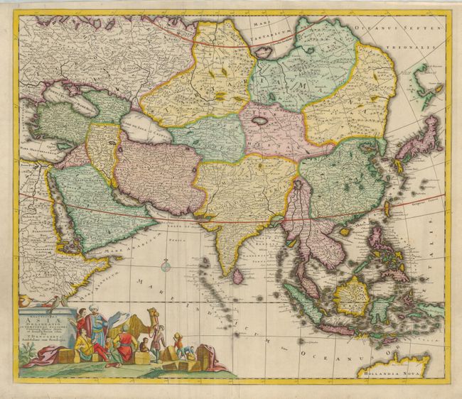
This handsome, large map of the Asian continent and East Indies is Danckerts' version of Frederick de Wit's 1675 map. The extent of European knowledge of the region is vividly depicted with good detail throughout the south and southeast reflecting the surveys of the Dutch East India Company, extending to include the northern coastline of Australia. The work of the Jesuit missionaries is reflected in the well-documented region of China, while there is less information presented in northern and central Asia. The large title cartouche includes a busy scene of traders bartering their goods.
References: Yeo #81.
Condition: B+
There is some extraneous creasing, a minor abrasion near the cartouche, and the map has been professionally backed with light Japanese tissue