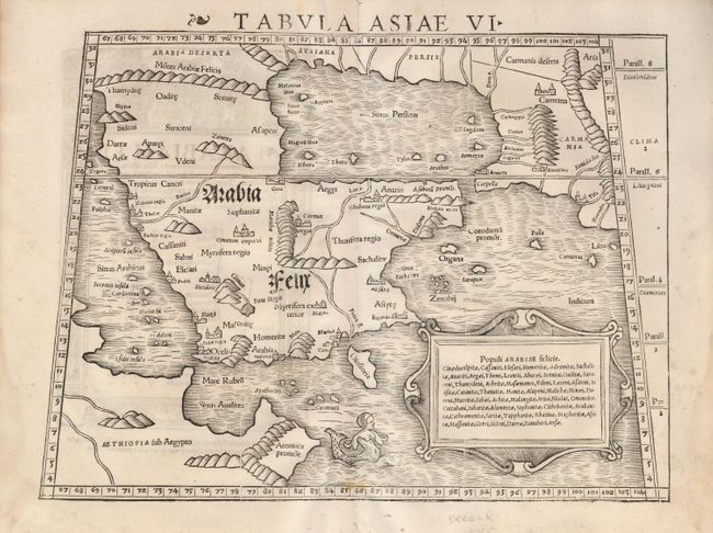
Subject: Arabia
Period: 1545 (circa)
Publication: Geographia Universalis
Color: Black & White
Size:
13.5 x 10.2 inches
34.3 x 25.9 cm
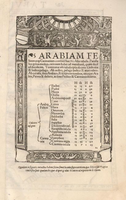
This fine woodcut is an early Ptolemaic map of the Arabian Peninsula here called Arabia Felix. It is a fairly good representation of the peninsula, although Ptolemy overestimated the width of the southern part of the peninsula and distorted the shape of the Arabian Gulf. The map is presented on a trapezoidal projection with parallels and meridians (forerunners of lines of longitude and latitude) enumerated in the borders. Major towns are named, although not accurately located, and the rivers are entirely imaginary. The cartouche includes the names of local tribes and a fanciful mermaid is shown in the sea. Latin text on verso contained in decorative border with columns at the sides and church dome above. This map was very influential and provided the basis on which European cartography depicted the region for nearly a century.
References: Mickwitz & Miekkavaara (Nordenskiold) #215-22.
Condition: A
Map image is very good with just two light spots in lower border. Wide margins, with a little staining or soiling and four worm holes in lower margin.