Subject: Antarctica and Southern Hemisphere
Period: 1817 (published)
Publication: Thomson's New General Atlas
Color: Hand Color
Size:
19.8 x 19.8 inches
50.3 x 50.3 cm
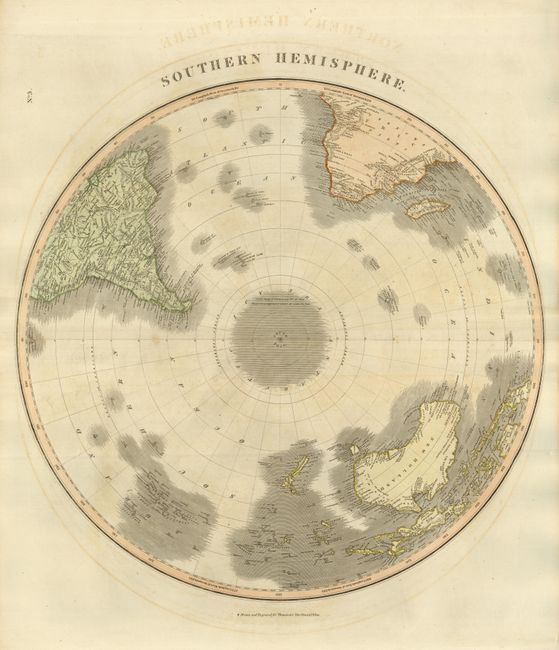
This large copper engraved hemispheric chart is centered on the South Pole. No Antarctic land mass is shown, but the area includes the notation "Cook's Highest Latitude was 71° 10'; from Thence Ice is supposed to extend all round the Pole." South Georgia Island is noted as "discovered by Cook in 1775." Shows all of New Zealand, Australia (New Holland), Papua New Guinea, and Madagascar. Map extends to the Equator to show the Amazon River in South America and above the Congo region and "The Red Wood Country" in Africa.
References:
Condition: B+
Very nice impression and original hand coloring on a full sheet with wide margins. A little offsetting or light foxing, otherwise very good.