Catalog Archive
Auction 128, Lot 67

"[Lot of 2] Facies Poli Arctici adiacentiumque ei regionum ex recentissimis itinerariis delineata cura Christophori Weigelii, Norib [and] Facies Poli Antarctici ex recentissimis itinerariis descripta", Weigel, Christopher

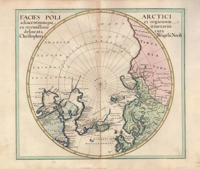
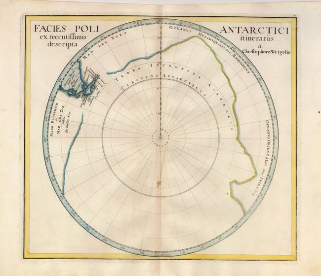
Subject: World, Polar

Period: 1718 (circa)

Publication:

Color: Hand Color

Size:
14 x 12.5 inches
35.6 x 31.8 cm
Download High Resolution Image
(or just click on image to launch the Zoom viewer)

This is a nice pair of uncommon polar charts. The chart of the Arctic labels the region of northwestern America America Septentrionalia Incognita and shows no western coast at all. Sir Thomas Smith's Bay, Sir Dudley Digs' Cape, Briggs his Bay, and scores of other early place names are noted on the shores of Hudson and Baffin Bays in the region labeled New South Wales and New North Wales. The chart of the Antarctic depicts a huge Terra Incognita Australis and includes Tierra del Fuego, the Strait of Magellan and the tip of South America.

References: Kershaw #414.

Condition: B

Light toning on centerfolds with some faint foxing.

Estimate: $500 - $700

Sold for: $375

Closed on 5/20/2009

Archived