Subject: Germany
Period: 1613-1700 (circa)
Publication:
Color: Hand Color
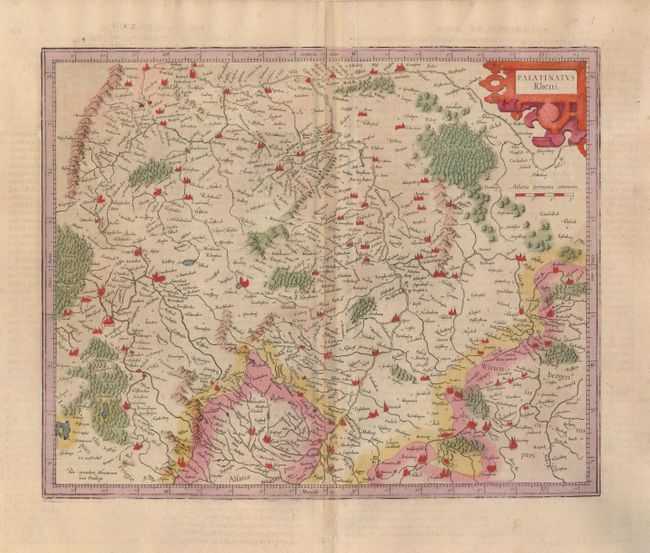
1) Palatinatus Rheni, by Gerard Mercator, circa 1613 (16.5 x 13.3"). This map illustrates the watershed of the Rhine River in great detail. It covers the region from Mainz to Baden. It is fully engraved to show mountains, rivers, lakes, forests, fortifications and tiny villages. The title is enclosed in a decorative strapwork cartouche. French text on verso. There is an old paper repair on the lower centerfold, just affecting the map border.
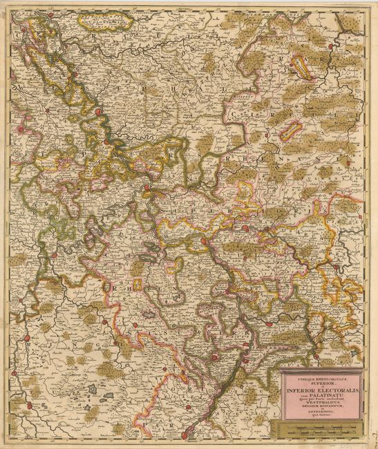
2) Uterque Rheni Circulus, Superior, et Inferior Electoralis, cum Palatinatu: Quos pro Parte Includunt Westphalicus, Belgium Hispanicum, et Lotharingia, qua Oriens, by Gerard Valk, circa 1700 (19.3 x 23"). This handsome map covers the Rhine River from Wesel to Strasburg. Valk’s maps are known for their high quality engraving and coloring. Major cities and towns on this map have been highlighted in red. Strong impression and original color with some oxidation of the green, which has been reinforced on verso with archival tape to prevent cracking.
References:
Condition: B+