Catalog Archive
Auction 128, Lot 641

"Turingiae Noviss. Descript. per Iohannem Mellinger Halens [on sheet with] Misniae et Lusatiae Tabula Descripta a M. Bartholemeo Sculteto Gorlit", Ortelius, Abraham
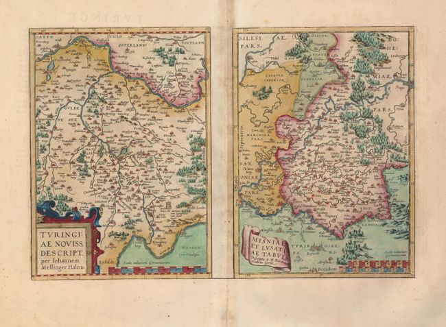
Subject: Germany

Period: 1574 (published)

Publication: Theatrum Orbis Terrarum

Color: Hand Color

Size:
17.5 x 11.5 inches
44.5 x 29.2 cm
Download High Resolution Image
(or just click on image to launch the Zoom viewer)

Two attractive maps on a folio sheet, each with their own margins and cartouches. Both maps have charming pictorial depictions of cities and topography. The map of Thuringia is focused roughly on Erfurt (Erfurdt), between the Saale and Werra Rivers, and is adorned with a strapwork cartouche. Ortelius based this map on the cartography of Johann Mellinger. The map of Misnia is based on the cartography of M. Bartolemy Sculteto. It is centered on Meissen with Gorlitz at the top of the map and Leipzig at the bottom. The Elbe River runs across the map, ending at Prague. Each map measures 8.3 x 11.5". From a French edition.

References: Van den Broecke #96.

Condition: B+

Old color with some toning on fold and in blank margins. A couple of minor tears in the blank margins have been repaired.

Estimate: $180 - $230

Unsold

Closed on 5/20/2009

Archived