Catalog Archive
Auction 128, Lot 637

"[WWII Escape Map - France and Central Europe]",

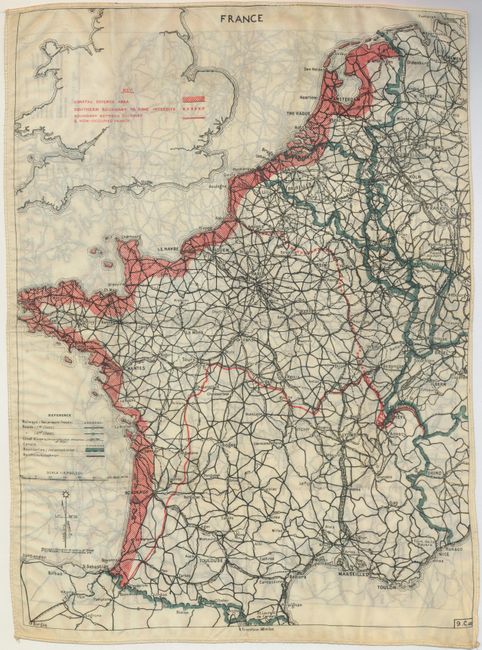
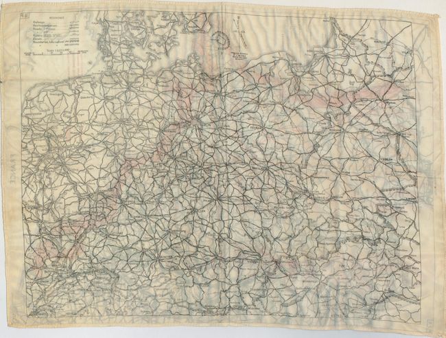
Subject: Central Europe

Period: 1942 (published)

Publication:

Color: Printed Color

Size:
15.8 x 22 inches
40.1 x 55.9 cm
Download High Resolution Image
(or just click on image to launch the Zoom viewer)

This is a very early WWII silk escape map, issued to RAF airmen to assist them in evading capture should they be shot down over enemy territory. This is one of the earliest such maps issued by the British military intelligence unit (MI9). Known as a Bartholomew map because it was derived from a cycling map produced by the famous Bartholomew map company of Edinburgh. The main map, numbered 9.C.(a) in the lower right border, covers France and is printed in three colors: map details in black, roads in red, and international boundaries in green. The map on the verso, 9.U, is printed solely in black on a white background. If you care to learn more about the history of these fascinating maps here is an excellent website.

References:

Condition: A+

Estimate: $275 - $350

Sold for: $210

Closed on 5/20/2009

Archived