Subject: Western Europe
Period: 1765 (circa)
Publication:
Color: Hand Color
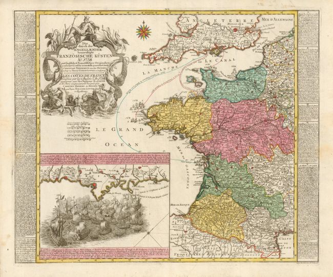
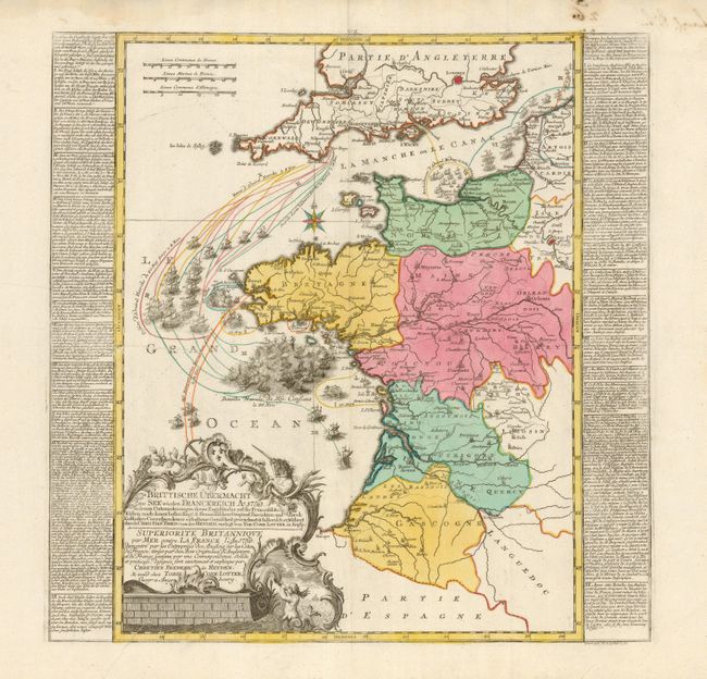
These superb maps describe the naval battles between the British and French during the Seven Years War (1756-1763). Annotations and numbered vignettes show the movement of fleets with extensive explanations in text panels (in German and French) flanking the maps. A large inset on the first map depicts the attack of a British naval force, commanded by Admirals Osborne and Saunders, on a French squadron off Cartagena, in southern Spain. Each map includes a finely engraved, large title cartouche. These beautiful and unusual maps were drawn by Christian Frederic von der Heyden, engraved by Mathias Albrecht Lotter, and published by Tobias Conrad Lotter. First measures 22.3 x 18.8" and second is 18.5 x 18.5" including the text panels.
References:
Condition: A
Very fine impression and original color. Manuscript brown ink notations on versos have bled through slightly in the top margins, with a little showing in the border of the second map.