Catalog Archive
Auction 128, Lot 57

"Altera Generalis Tab. Secundum Ptol.", Munster, Sebastian

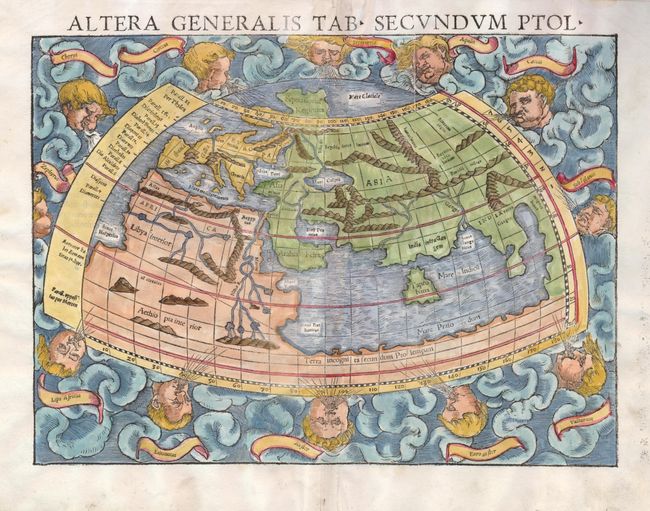
Subject: Ancient World

Period: 1545 (circa)

Publication: Geographia…

Color: Hand Color

Size:
13.5 x 10 inches
34.3 x 25.4 cm
Download High Resolution Image
(or just click on image to launch the Zoom viewer)

This woodcut, Ptolemaic world map is surrounded by clouds and eleven wind heads (with their names shown in the banners). The continents are oddly shaped and all connected by a great southern continent Terra incognito secundum Ptolemaeum. There is a very large Taprobana (modern day Sri Lanka) in the Indian Ocean, and the Indian subcontinent is severely truncated. Only the northern part of Africa is shown with the Nile originating from a series of lakes in a large mountain range. Latin title and text on verso.

References: Shirley #76.

Condition: A

There are a couple edge tears and remnants of linen hinges on verso.

Estimate: $950 - $1,200

Sold for: $1,000

Closed on 5/20/2009

Archived